Hortolândia, Industrial municipality near Campinas, Brazil.
Hortolândia is a municipality in São Paulo state, located roughly 110 kilometers northwest of the capital. The town sits on rolling terrain at an elevation around 587 meters and is connected to surrounding communities by several major roads.
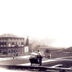
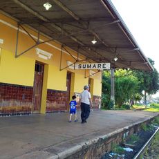
The area was once known as Jacuba and served as a telegraph station along the railway line from 1896 onward. In May 1991 residents voted to separate from Sumaré and formed their own municipality.
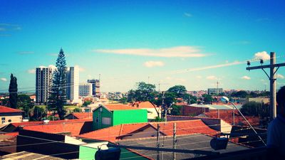
The name comes from earlier vegetable gardens that were planted here before the town turned into a technology center. Many residents work in nearby factories or commute daily to Campinas, which means housing areas sit next to industrial zones.
The town is best reached via the Anhanguera or Bandeirantes highways, both running from São Paulo toward Campinas. Visitors find few central walkable areas, so a vehicle is helpful for longer distances.
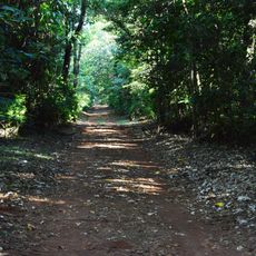
Less than two percent of the original Atlantic Forest remains today, most of it lost since the 1980s. The town has carried its current name only since 1991, previously going by Jacuba for over ninety years.
Location: São Paulo
Inception: May 19, 1991
Elevation above the sea: 587 m
Shares border with: Sumaré, Campinas, Monte Mor
Website: http://hortolandia.sp.gov.br
GPS coordinates: -22.85833,-47.22000
Latest update: December 13, 2025 17:15
Mata de Santa Genebra
12 km
Fazenda Santa Genebra
7 km
Moradia da Unicamp
14.1 km
Estádio Municipal Luís Perissinotto
12.7 km
Complexo Viário SP 332-PLN 010/020
12.3 km
Museu Municipal de Hortolândia - Estação Jacuba
240 m
Prédio da antiga estação ferroviária de Sumaré
6.1 km
Museu de blindados
13.3 km
Barramento Lopes II
10.3 km
Tanque de Água
9.1 km
Barragem da Lagoa
14 km
TBK 4
9.3 km
Represa do Marcelo Pedroni
7.4 km
Jardim Botânico Municipal de Paulínia Adelmo Piva Junior
13.1 km
Represa Horto Florestal de Sumaré
3.9 km
Biblioteca Pública Municipal "Valter Borges de Salles
11.9 km
Museu da Criatividade Popular de Paulínia
12.4 km
Parque Socioambiental Chico Mendes
488 m
Cristo Redentor
11.8 km
Chácara Recanto Vó Maria
8.2 km
Sambódromo Florindo Ferreira (DÓIA)
9.6 km
Parque repressa marcelo pedroni
7.5 km
Centro de Convivência Cultural Maria Monteiro
6.6 km
Theatro Municipal Paulo Gracindo (Teatro Municipal de Paulínia)
10.2 km
Teatro Municipal
11.1 km
Conjunto Aquático Almir Beraldo
10.7 km
Homenagem a Ulysses Guimarães
13.8 km
Guarda Civil de Paulínia Prédio Alcides Leopoldino da Fonseca
12.9 kmVisited this place? Tap the stars to rate it and share your experience / photos with the community! Try now! You can cancel it anytime.
Discover hidden gems everywhere you go!
From secret cafés to breathtaking viewpoints, skip the crowded tourist spots and find places that match your style. Our app makes it easy with voice search, smart filtering, route optimization, and insider tips from travelers worldwide. Download now for the complete mobile experience.
A unique approach to discovering new places❞
— Le Figaro
All the places worth exploring❞
— France Info
A tailor-made excursion in just a few clicks❞
— 20 Minutes