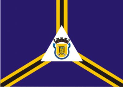
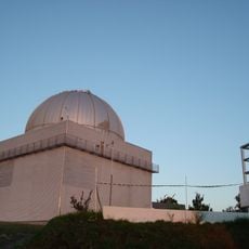
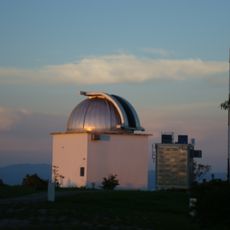
Itajubá, Mountain municipality in Minas Gerais, Brazil.
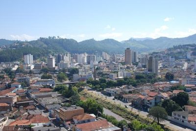
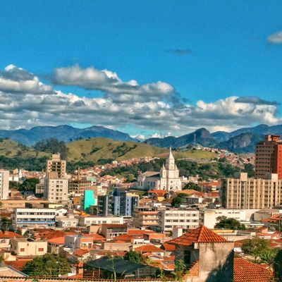
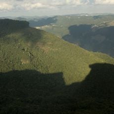
Itajubá sits in a valley along the Sapucaí River where streets spread between wooded hills of the Serra da Mantiqueira. Buildings extend from the riverbank to gentle slopes that frame the valley and give the town a green backdrop.
A priest led eighty families from a nearby settlement here in 1819 to found a new community by the river. The place grew over time into a regional center for education and industry and later received a technical university.
The federal university draws students from across the country and shapes the street life with bookshops and small cafés around the campus. On weekdays young people move between lectures through the center and bring shops and squares to life with their presence.
Roads connect the place with larger cities in the region and make day trips or longer stays easy to plan. The river and mountains offer landmarks that help with finding your way around the center and outlying areas.
A local factory produces military equipment and manufactures licensed rifles as well as combat knives for the Brazilian armed forces. Production has run for decades and makes the place one of the few civilian sites with this specialization in the country.
Location: Minas Gerais
Elevation above the sea: 871 m
Shares border with: São José do Alegre, Piranguinho, Piranguçu, Delfim Moreira, Maria da Fé, Wenceslau Braz
Website: http://itajuba.mg.gov.br
GPS coordinates: -22.42583,-45.45278
Latest update: December 13, 2025 18:51
Pico dos Dias Observatory
18 km
Serra da Mantiqueira Environmental Protection Area
28.9 km
1.6m Perkin-Elmer
18.1 km
0.6m Boller & Chivens
18.1 km0.6m Zeiss Jena
18.1 kmMuseu Histórico e Cultural de Delfim Moreira
20.2 kmMuseu Militar Marechal Juarez Távora
1.7 kmMemorial da Câmara Municipal de Itajubá
487 mMuseu Municipal Wenceslau Braz
785 mRoda Gigante
608 mPonte da Imbel
2.9 kmBarreirinho
12.7 kmPedra Focinho de Cão
29.8 kmTeatro Cristiane Riera
2.3 kmCachoeira do Diamante
23.6 kmObra de arte Bandeira do Brasil
1 kmMirante Vó Cotinha
18.2 kmScenic viewpoint
16.3 kmCruzeiro
29.9 kmScenic viewpoint
15.1 kmCachoeira do Cubatão
28.5 kmCachoeira do Ano Bom
9 kmWaterfall
21.1 kmCachoeira da Boa Esperança
22.2 kmCachoeira do Alto
22.2 kmCachoeira entre Rios
22.4 kmCachoeira do Topo
23 kmCachoeira da Estância
6.8 kmVisited this place? Tap the stars to rate it and share your experience / photos with the community! Try now! You can cancel it anytime.
Discover hidden gems everywhere you go!
From secret cafés to breathtaking viewpoints, skip the crowded tourist spots and find places that match your style. Our app makes it easy with voice search, smart filtering, route optimization, and insider tips from travelers worldwide. Download now for the complete mobile experience.
A unique approach to discovering new places❞
— Le Figaro
All the places worth exploring❞
— France Info
A tailor-made excursion in just a few clicks❞
— 20 Minutes