Queimados, Municipality in Rio de Janeiro, Brazil
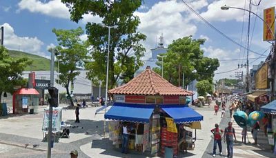
Queimados is a municipality in Rio de Janeiro comprising residential neighborhoods and commercial areas spread across varied terrain. The city displays a typical mix of urban structures with local streets winding through residential and business districts.
The municipality was established in 1990 through separation from neighboring administrative areas, creating its own independent governance. This administrative reorganization shaped the area's modern development.
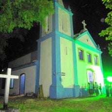
The Nossa Senhora da Conceição Church in the commercial center serves as a gathering place for the local community, reflecting the religious traditions that shape daily life. The building draws visitors interested in understanding the cultural roots of the region.
The municipality connects to the regional transport network via the Japeri train line and maintains frequent bus services to nearby centers. Pedestrians can find local shops and services concentrated along the main streets of the commercial district.
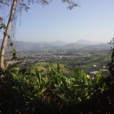
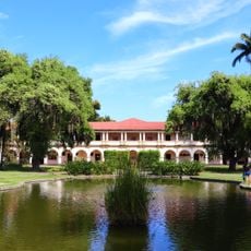
A protected environmental area within the municipal boundaries serves as a space for educational activities and nature-based learning. The area is used by photographers and educators to explore and document local ecology.
Location: Rio de Janeiro
Inception: December 21, 1990
Elevation above the sea: 29 m
Shares border with: Japeri, Nova Iguaçu, Seropédica
Website: http://queimados.rj.gov.br
GPS coordinates: -22.71583,-43.55500
Latest update: December 17, 2025 10:25
Nova Iguaçu Volcano
9.7 km
Mendanha State Park
11.4 kmJaceruba Environmental Protection Area
9.9 kmPico do Guandu
11.5 kmMorro do Marapic
14.1 kmMorro do Vieira
12.6 km
Igreja Nossa Senhora Conceição de Marapicu
9.7 kmCapela Nossa Senhora de Guadalupe
11.1 kmReservatório de Rio D’Ouro
9.4 kmCapela da Fazenda da Posse
10.3 kmMorro do Mariano
13.6 km
Conjunto arquitetônico e paisagístico da Universidade Federal Rural do Rio de Janeiro
14.6 kmPico da Furna das Andorinhas
12.3 kmInstituto de Pesquisas Afro Cultural Odé Gbomi
6.6 kmJardim Botânico da Universidade Federal Rural do Rio de Janeiro
13.2 kmEspaço Cultural Antônio Fraga
475 mParadiso Club
6 kmGustavão
14.8 kmTeatro Metodista
1.2 kmEscultura
840 mReservatório Rio D'Ouro
9.4 kmParquinho da Vila
946 mToboaqua
14.6 kmMirante da Rampa de Voo Livre
9.4 kmCéu Aberto
10.3 kmScenic viewpoint
9.9 kmScenic viewpoint
10 kmPoção
11.9 kmVisited this place? Tap the stars to rate it and share your experience / photos with the community! Try now! You can cancel it anytime.
Discover hidden gems everywhere you go!
From secret cafés to breathtaking viewpoints, skip the crowded tourist spots and find places that match your style. Our app makes it easy with voice search, smart filtering, route optimization, and insider tips from travelers worldwide. Download now for the complete mobile experience.
A unique approach to discovering new places❞
— Le Figaro
All the places worth exploring❞
— France Info
A tailor-made excursion in just a few clicks❞
— 20 Minutes