Bananal, Mountain municipality in São Paulo, Brazil
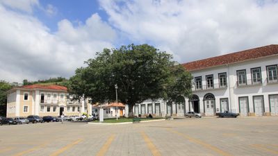
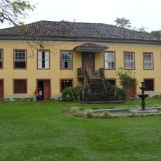
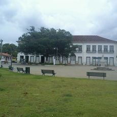
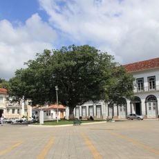
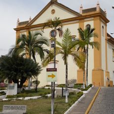
Bananal is a municipality in São Paulo set among green hills in a hilly region of the state. The town sits elevated within a landscape of valleys and forested areas.
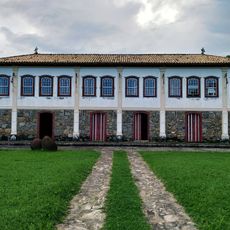
The municipality was established in 1783 and developed as an administrative division of São Paulo state. This early founding placed it within the region's system of local governance.
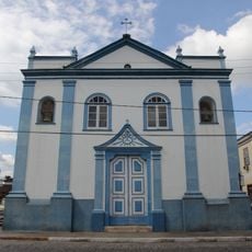
Local residents gather for community festivals and celebrations that mark the rhythm of daily life in the municipality. These events reflect how people maintain connections within their small town setting.
The municipality offers basic services and sits along established transportation connections to the state capital. Its location allows visitors to explore while staying linked to regional amenities.
The name comes from banana plantations that were common in the area during its early settlement. This agricultural connection remains woven into the municipality's identity.
Location: São Paulo
Inception: 1783
Elevation above the sea: 893 m
Shares border with: Barra Mansa, Arapeí, Angra dos Reis, Resende, Rio Claro, São José do Barreiro
Website: http://bananal.sp.gov.br
GPS coordinates: -22.68389,-44.32278
Latest update: December 7, 2025 09:28
Carmo Church (Angra dos Reis)
35.9 km
Fazenda Resgate
8.4 km
São Bernardino de Sena Convent
35.9 km
Pharmácia Popular
197 m
Anil Beach
35.9 km
Santa Luzia Church (Angra dos Reis)
36.1 km
Fazenda Pau d'Alho
29.6 km
Ayrton Senna Avenue
35.8 km
Fazenda dos Coqueiros
4.1 km
Solar Aguiar Valim
114 m
Cachoeira Santo Isidro
30.8 km
Fazenda Loanda - Vale do Café
10 km
Fazenda Pau d'alho
29.7 km
Centro Histórico de Bananal
137 m
Edifício à Praça da Bandeira
22.1 km
Igreja do Rosário
192 m
Building at Avenida Bom Jesus, 93
360 m
Fazenda da Posse - Barra Mansa RJ
22.8 km
Igreja Matriz
21 m
Building at Praça Rubião Júnior, 305
95 m
Building at Rua Manoel de Aguiar, 161
199 m
Building at Praça Pedro Ramos, 45
75 m
Building at Rua Manoel de Aguiar, 51
95 m
Casa à Praça General Osório
36 km
Building at Rua Manoel de Aguiar, 155
197 m
Building at Rua Manoel de Aguiar, 151
189 m
Monument to the Magi
35.9 km
Central Mill of Bracuhy
30.3 kmVisited this place? Tap the stars to rate it and share your experience / photos with the community! Try now! You can cancel it anytime.
Discover hidden gems everywhere you go!
From secret cafés to breathtaking viewpoints, skip the crowded tourist spots and find places that match your style. Our app makes it easy with voice search, smart filtering, route optimization, and insider tips from travelers worldwide. Download now for the complete mobile experience.
A unique approach to discovering new places❞
— Le Figaro
All the places worth exploring❞
— France Info
A tailor-made excursion in just a few clicks❞
— 20 Minutes