Teresópolis, Mountain municipality in Rio de Janeiro, Brazil
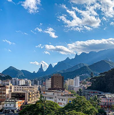
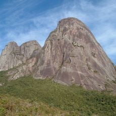
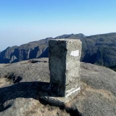
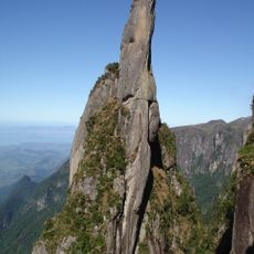
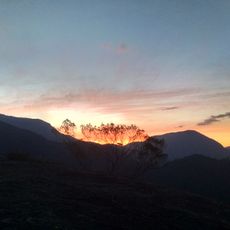
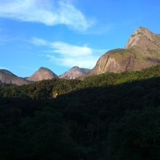
Teresópolis is a municipality in the mountain region of Rio de Janeiro state at an elevation of 894 meters, spreading across hilly terrain. The town sits among forested slopes and provides access to Serra dos Órgãos National Park with its marked peaks.
The municipality grew from the village of Freguesia de Santo Antonio de Paquequer and was officially founded in 1891. Its name was chosen to honor Empress Teresa Cristina and recalls the time of the Brazilian Empire.
The name honors Empress Teresa Cristina and reflects the region's monarchical past. Visitors today still see farmers' markets where locals sell fresh vegetables and flowers from the surrounding mountain farms.
The national park offers several entrances with marked hiking trails leading to mountain peaks and viewpoints. Hikers should start early in the morning and bring proper gear for the mountain climate.
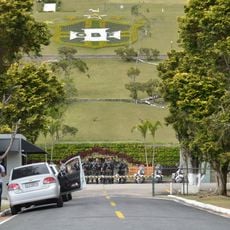
The Brazilian national football team uses the Granja Comary training facility regularly for preparation camps due to the mild mountain climate. Players train here before major tournaments in a quiet environment away from the big city.
Location: Rio de Janeiro
Inception: 1891
Elevation above the sea: 894 m
Shares border with: Cachoeiras de Macacu
Website: http://teresopolis.rj.gov.br
GPS coordinates: -22.41194,-42.96583
Latest update: December 13, 2025 16:17
Três Picos State Park
17.7 km
Bell Stone
8.7 km
Granja Comary
4.6 km
Mirante da Granja Guarani
4.3 km
Aguja del Diablo
8.2 km
Montanhas de Teresópolis Municipal Nature Park
10 km
Colina do Mirante
2 km
Casa da Memória Arthur Dalmasso
74 m
Bacia dos Frades Environmental Protection Area
21.6 kmAraponga Municipal Nature Park
19.7 kmFloresta do Jacarandá Environmental Protection Area
4.5 kmPedra das Flores Natural Monument
29.3 kmMaravilha Environmental Protection Area
27.3 kmCasa das Irmãs Perry
449 mPonte Sloper
4.4 kmCascata do Imbuí
3.3 kmMorro da Onça
15.3 kmCascata Guarani
1.9 kmParque Japuíba
5.1 kmMorro Agudo
22.2 kmPedra do Paquequer
25.8 kmHigino Country Club
3.2 kmCascata Fischer
4.5 kmPedra da Ermitage
3.3 kmMorro do Carmo
19.4 kmMorro do André
12.5 kmAlto da Boa Vista
5.5 kmTaberna Alpina
189 mVisited this place? Tap the stars to rate it and share your experience / photos with the community! Try now! You can cancel it anytime.
Discover hidden gems everywhere you go!
From secret cafés to breathtaking viewpoints, skip the crowded tourist spots and find places that match your style. Our app makes it easy with voice search, smart filtering, route optimization, and insider tips from travelers worldwide. Download now for the complete mobile experience.
A unique approach to discovering new places❞
— Le Figaro
All the places worth exploring❞
— France Info
A tailor-made excursion in just a few clicks❞
— 20 Minutes