Sacramento, Administrative division in Minas Gerais, Brazil.
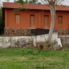
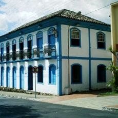
Sacramento is a municipality in Minas Gerais in southeastern Brazil with around 7,000 residents spread across gently rolling landscape. The town center clusters around a small church, while residential areas and shops arrange themselves in a quiet, unhurried way.
The municipality originated in the late 17th century during the gold rush phase in Minas Gerais, when prospectors explored the region. Later, the economy shifted from mining to farming, which explains the current presence of farms and livestock raising.
The Fest de São Sebastião brings the town together annually, with residents joining traditional processions and sharing regional dishes. The celebration shows how faith and local identity remain closely connected here.
The town is reachable via state highways from larger neighboring towns and has a network of local paved roads. Visitors find simple accommodations and restaurants in the center, and there is adequate parking for cars.
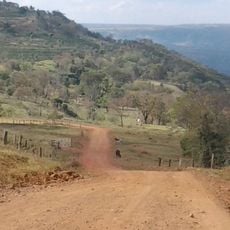
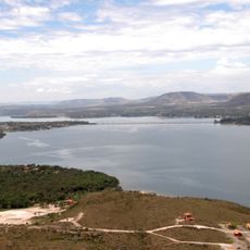
Nearby springs and streams have been used by residents for generations and remain important to daily life. These water sources are popular spots for walking and gathering, woven into local routines.
Location: Minas Gerais
Elevation above the sea: 832 m
Shares border with: Delfinópolis, São Roque de Minas, Ibiraci, Araxá, Conquista, Nova Ponte, Perdizes, Santa Juliana, Uberaba, Tapira, Pedregulho, Rifaina
Website: https://sacramento.mg.gov.br
GPS coordinates: -19.86500,-47.44000
Latest update: December 7, 2025 09:20
Serra da Canastra National Park
107.2 km
Estádio Parque do Sabiá
134.7 km
Casca d'Anta
107.6 km
Museu Casa de Portinari
127.8 km
Dinosaur Museum
34.5 km
Mascarenhas de Morais Dam
61.1 km
Relógio Solar de Franca
75.1 km
Saint Rita church, Uberaba
53 km
José Chiachiri Municipal Historical Museum
74.8 km
Estádio Juca Ribeiro
137.4 km
Praça das Esculturas
129 km
Furnas do Bom Jesus State Park
40.8 km
Museu da Cana
147.5 km
Pinacoteca Municipal Miguel Ângelo Pucci
74.6 km
Cachoeira da Capivara
147.4 km
Estação Ferroviário Entroncamento
139.2 km
Antiga Estação do Cipó
11 km
Paraíso Perdido
144.1 km
Cervejaria Paulista
150.4 km
Museu Municipal Dona Beja
60.9 km
Complexo Hidrotermal e Hoteleiro do Barreiro
56.9 km
Horizonte Perdido
64.3 km
Bridge over the river Turvo
155 km
Calmon Barreto museum
60.8 km
Jaguara reservoir
24.5 km
Canyon de Furnas
150.2 km
Termas de Araxá
56.7 km
Monumento em Homenagem aos Profissionais da Saúde (Piumhi/MG)
168.9 kmVisited this place? Tap the stars to rate it and share your experience / photos with the community! Try now! You can cancel it anytime.
Discover hidden gems everywhere you go!
From secret cafés to breathtaking viewpoints, skip the crowded tourist spots and find places that match your style. Our app makes it easy with voice search, smart filtering, route optimization, and insider tips from travelers worldwide. Download now for the complete mobile experience.
A unique approach to discovering new places❞
— Le Figaro
All the places worth exploring❞
— France Info
A tailor-made excursion in just a few clicks❞
— 20 Minutes