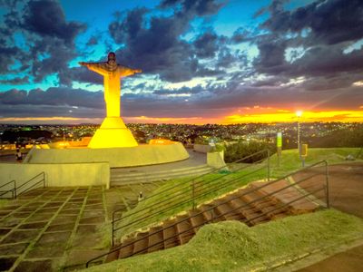
Araxá, Municipality in Minas Gerais, Brazil.
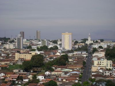
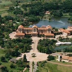
Araxá sits in the central highlands of Minas Gerais, where gentle hills give way to higher mountain ranges. The town spreads across a wide valley, with residential neighborhoods interspersed among agricultural land and industrial zones.
Explorers reached the area in the mid-1600s and encountered the indigenous Araxá people, from whom the place takes its name. The settlement grew through agriculture and mining, especially after mineral deposits were discovered in the 20th century.
The population of 111,691 residents comprises 50.18% White, 38.71% Pardo, 10.78% Black, 0.25% Asian, and 0.07% Indigenous peoples.
A regional airport connects the town with larger centers, while several bus lines link the downtown area with outlying neighborhoods. Health services and pharmacies are spread throughout the urban area.
Large deposits of niobium lie in the surrounding area and are extracted in mines that rank among the most important in the world. This metal is used in the production of specialty steels and alloys.
Location: Minas Gerais
Inception: December 19, 1865
Elevation above the sea: 973 m
Shares border with: Perdizes, Ibiá, Sacramento, Tapira
Website: http://araxa.mg.gov.br
GPS coordinates: -19.59278,-46.94083
Latest update: December 4, 2025 23:42
Serra da Canastra National Park
86.5 km
Estádio Parque do Sabiá
155.4 km
Casca d'Anta
90.3 km
Museu Casa de Portinari
173.1 km
Dinosaur Museum
85.7 km
Mascarenhas de Morais Dam
78.2 km
Relógio Solar de Franca
115.7 km
Saint Rita church, Uberaba
105.3 km
St. Anthony of Padua Cathedral, Patos de Minas
120.4 km
José Chiachiri Municipal Historical Museum
115.4 km
Estádio Juca Ribeiro
159.1 km
Praça das Esculturas
165.3 km
Patos de Minas
120.3 km
Furnas do Bom Jesus State Park
88.3 km
Pinacoteca Municipal Miguel Ângelo Pucci
115.2 km
Cachoeira da Capivara
134.1 km
Antiga Estação do Cipó
69.2 km
Paraíso Perdido
131.9 km
E.E. Coronel Francisco Martins
115.2 km
E.M.E.F. Coronel Joaquim da Cunha
165.8 km
Cinemais Patos de Minas
120.7 km
Museu Municipal Dona Beja
473 m
Calmon Barreto museum
383 m
Complexo Hidrotermal e Hoteleiro do Barreiro
6 km
Horizonte Perdido
16.1 km
Bridge over the river Turvo
140.3 km
Jaguara reservoir
72.5 km
Canyon de Furnas
136.8 kmVisited this place? Tap the stars to rate it and share your experience / photos with the community! Try now! You can cancel it anytime.
Discover hidden gems everywhere you go!
From secret cafés to breathtaking viewpoints, skip the crowded tourist spots and find places that match your style. Our app makes it easy with voice search, smart filtering, route optimization, and insider tips from travelers worldwide. Download now for the complete mobile experience.
A unique approach to discovering new places❞
— Le Figaro
All the places worth exploring❞
— France Info
A tailor-made excursion in just a few clicks❞
— 20 Minutes