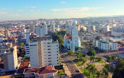
Patos de Minas, Municipality in Alto Paranaíba region, Minas Gerais, Brazil.
Patos de Minas is a city in the western part of Minas Gerais state, in the Alto Paranaíba uplands. The municipality covers several neighborhoods and agricultural areas beyond the center.
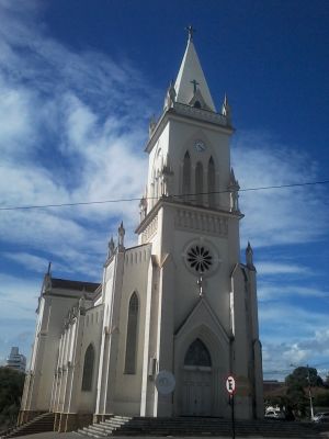
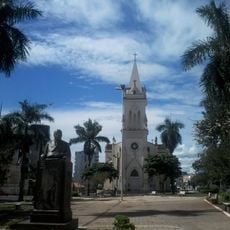
A plot of land was donated in the 19th century for a chapel, around which a settlement formed. The municipality later received city status in the same century and developed into an agricultural center.
The National Corn Festival in May presents rodeos and country music performances, celebrating the agricultural heritage of the region.
A regional airport connects the city with the state capital through scheduled flights. The city sits on a route that can be reached by road from several neighboring towns.
The city processes phosphate fertilizers and maintains extensive corn cultivation, covering 12,000 hectares of agricultural land.
Location: Minas Gerais
Inception: 1868
Elevation above the sea: 815 m
Shares border with: Carmo do Paranaíba, Coromandel, Cruzeiro da Fortaleza, Guimarânia, Lagamar, Lagoa Formosa, Presidente Olegário, Serra do Salitre, Tiros, Varjão de Minas
Website: http://patosdeminas.mg.gov.br
GPS coordinates: -18.58714,-46.51494
Latest update: December 4, 2025 23:04
Serra da Canastra National Park
185.1 km
Estádio Parque do Sabiá
184.7 km
Casca d'Anta
190.9 km
Dinosaur Museum
182.3 km
Mascarenhas de Morais Dam
197.7 km
St. Anthony of Padua Cathedral, Patos de Minas
272 m
Parish Church of Saint Antony
156.5 km
Estádio Genervino da Fonseca
159 km
Estádio Juca Ribeiro
188.7 km
Patos de Minas
2 km
Três Marias Reservoir
134.4 km
Father Belchior's House
209.8 km
AABB
210.7 km
Antiga Estação do Cipó
183 km
Chapel of Senhor Bom Jesus
210 km
Our Lady of the Rosary church, Paracatu
156.7 km
Saint Francis of Assisi Church
209.9 km
Cinemais Patos de Minas
195 m
Museu Municipal Dona Beja
120.1 km
Saint Anne Church (Paracatu, Brazil)
155.9 km
Historic center of Paracatu
156.4 km
Calmon Barreto museum
120.3 km
Igreja de Nossa Senhora do Pilar
210 km
Casa de Cultura, Paracatu
156.5 km
Complexo Hidrotermal e Hoteleiro do Barreiro
126.4 km
Horizonte Perdido
129.7 km
Capela da Cruz do Monte
208.6 km
Jaguara reservoir
190.5 kmVisited this place? Tap the stars to rate it and share your experience / photos with the community! Try now! You can cancel it anytime.
Discover hidden gems everywhere you go!
From secret cafés to breathtaking viewpoints, skip the crowded tourist spots and find places that match your style. Our app makes it easy with voice search, smart filtering, route optimization, and insider tips from travelers worldwide. Download now for the complete mobile experience.
A unique approach to discovering new places❞
— Le Figaro
All the places worth exploring❞
— France Info
A tailor-made excursion in just a few clicks❞
— 20 Minutes