São Sebastião do Alto, Municipality in Rio de Janeiro state, Brazil
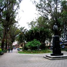
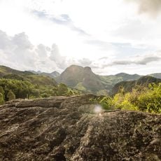
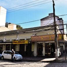
São Sebastião do Alto is a municipality nestled in the highlands of Rio de Janeiro state, situated at approximately 575 meters elevation. The terrain spans rolling hills and agricultural lands that connect with neighboring communities across the region.
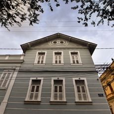
The municipality was officially established on April 17, 1891, representing a key moment in the administrative formation of the region. Since then, it has developed as a rural community rooted in farming and livestock activities.
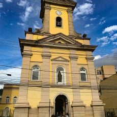
The patron saint São Sebastião gives the place its name, and religious processions move through the community during celebrations throughout the year. These gatherings show how faith remains part of everyday life here.
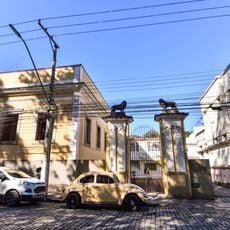
The municipality connects to surrounding areas including Macuco, Cantagalo, and Santa Maria Madalena through road networks. Visitors should keep in mind that the rural setting means limited public transportation, making a personal vehicle helpful for exploring the area.
The municipal coat of arms was designed in 1954 by educator Beatriz Fajardo de Oliveira Viana and depicts symbols of livestock and farming. This artwork reflects the economic foundations on which the community has built its identity since its founding.
Location: Rio de Janeiro
Elevation above the sea: 575 m
Shares border with: Cantagalo, Itaocara, Macuco, Santa Maria Madalena, São Fidélis, Trajano de Morais
Website: http://ssalto.rj.gov.br
GPS coordinates: -21.95694,-42.13500
Latest update: December 8, 2025 13:43
Mesquita Brasil
49 km
Desengano State Park
26.2 km
Pico Peito do Pombo
38.9 km
Forte Marechal Hermes
60 km
União Biological Reserve
53.3 km
Praça Getúlio Vargas
54.6 km
Macaé de Cima Environmental Protection Area
53.6 km
Cúria Metropolitana de Nova Friburgo
54.4 km
Catedral Metropolitana de São João Batista
54.5 km
Antiga Residência do Barão de Nova Friburgo
54.6 km
Prefeitura Municipal de Nova Friburgo
55.1 km
Imóvel à Praça Getúlio Vargas, nº 55
54.6 km
Imóvel à Praça Demerval Barbosa Moreira, nº 45
54.6 km
Ponte Metálica sobre o Rio Paraíba do Sul
53.3 km
Sede da Legião Brasileira de Assistência
54.5 km
Correios
54.6 km
Faculdade de Odontologia de Nova Friburgo
54.5 km
Imóvel à Praça Getúlio Vargas, nº 126,128 e 130
54.5 km
Imóvel à Praça Demerval Barbosa Moreira, nº 36
54.6 km
Imóvel à Praça Getúlio Vargas, nº 116 e 120
54.5 km
Imóvel à Praça Getúlio Vargas, nº 84
54.5 km
Imóvel à Praça Getúlio Vargas, nº 102
54.5 km
Edifício Spinelli
54.5 km
Residência de Galdino do Valle Filho
55.1 km
Imóvel à Praça Demerval Barbosa Moreira, nº 30
54.6 km
Coreto da praça João XXIII
24.2 km
Imóvel à Praça Getúlio Vargas, nº 96
54.5 km
Imóvel à Praça Getúlio Vargas, nº 88
54.5 kmVisited this place? Tap the stars to rate it and share your experience / photos with the community! Try now! You can cancel it anytime.
Discover hidden gems everywhere you go!
From secret cafés to breathtaking viewpoints, skip the crowded tourist spots and find places that match your style. Our app makes it easy with voice search, smart filtering, route optimization, and insider tips from travelers worldwide. Download now for the complete mobile experience.
A unique approach to discovering new places❞
— Le Figaro
All the places worth exploring❞
— France Info
A tailor-made excursion in just a few clicks❞
— 20 Minutes