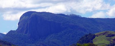
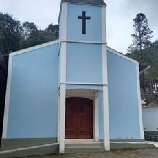
Goiapaba-Açu, Mountain summit in Fundão, Brazil
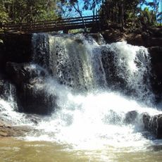
Goiapaba-Açu is a mountain summit reaching 859 meters (2,818 feet) surrounded by varied vegetation and located within a protected natural area. The peak offers expansive views across the surrounding landscape and down toward the coastal zones of the region.
Indigenous Tupi people gave this mountain its name based on the birds inhabiting the area for centuries. In recent times, the mountain became part of a protected ecological corridor established to preserve the region's natural heritage.
The mountain carries a name rooted in indigenous language, reflecting the connection between this place and the birds that live here. Visitors walking through the slopes can see how the local environment has shaped both the name and the identity of the summit.
Bring sturdy footwear and water when hiking the trails, as conditions vary with weather and season. Contacting the site administration beforehand helps ensure access and learn about current trail conditions.
A dedicated paragliding takeoff point sits at the summit, allowing flyers to soar above coastal areas and valleys below. This feature attracts experienced pilots who seek aerial perspectives of the surrounding landscape.
Location: Fundão
Elevation above the sea: 859 m
GPS coordinates: -19.91500,-40.47583
Latest update: December 14, 2025 20:02
Buddha of Ibiraçu
10.6 km
Mosteiro Zen Morro da Vargem
10.6 kmAugusto Ruschi Biological Reserve
9.1 km
Quilombo Retiro
20.9 km
Goiapaba-Açu Municipal Nature Park
710 m
Casa da Cultura de Fundão
7.5 km
Residência Augusto Ruschi
13.2 km
Pittol Family Mansion
15.1 km
Edifício na Rua do Comércio nº 54
21.3 km
Monumento ao Imigrante
21.1 km
Edifício na Rua do Comércio nº 14, 16, 18 e 20
21.3 km
Sumidouro e Cachoeira do Funil
21 km
Herzog Family Mansion
21.2 km
Edifício na Rua do Comércio nº 24
21.3 km
Edifício na Rua do Comércio nº 3
21.4 km
Igrejinha
12.3 km
Edifício na Rua Jerônimo Monteiro nº 43
21.3 km
Edifício na Rua Jerônimo Monteiro nº 8
21.1 km
Lower Church
21.2 km
Edifício na Rua Jerônimo Monteiro nº 2
21.1 km
Edifício na Rua do Comércio nº 2
21.3 km
Edifício na Rua Jerônimo Monteiro nº 10
21.2 km
Old Mansion of Dona Zezé
21.3 km
Edifício na Rua Bernardino Monteiro nº 18
21.2 km
Rua Jerônimo Monteiro, 16
21.2 km
Capela de Nossa Senhora da Conceição
13.6 km
Virgilio Lambert Residence
13.6 km
Waterfall
15.8 kmVisited this place? Tap the stars to rate it and share your experience / photos with the community! Try now! You can cancel it anytime.
Discover hidden gems everywhere you go!
From secret cafés to breathtaking viewpoints, skip the crowded tourist spots and find places that match your style. Our app makes it easy with voice search, smart filtering, route optimization, and insider tips from travelers worldwide. Download now for the complete mobile experience.
A unique approach to discovering new places❞
— Le Figaro
All the places worth exploring❞
— France Info
A tailor-made excursion in just a few clicks❞
— 20 Minutes