Enable Location

We need your location to show you interesting places around you

Discover nearby places

Find interesting locations and hidden gems around you

Precise directions

Get accurate directions and distances to places

Your location is never shared with other users. It's only used when you tap the location button.

Domingos Martins

Log in to your account

Start exploring — it's free

Trusted by 62,854 travelers worldwide

Continue with Google
Continue with Apple
or

We will send you a code to connect

By continuing, you accept our Terms and Conditions and our Privacy Policy

Check your inbox

We've sent a pincode in your inbox. Please enter the code below.

Domingos Martins, Mountain municipality in Espirito Santo, Brazil

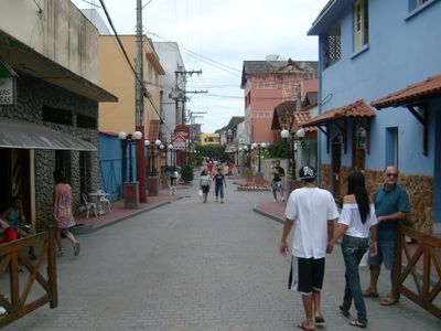
Domingos Martins is a mountain municipality in Espírito Santo where the terrain rises between 800 and 2000 meters above sea level. Five districts spread across this highland landscape connected by roads, with Pedra Azul marking one of the highest points in the region.

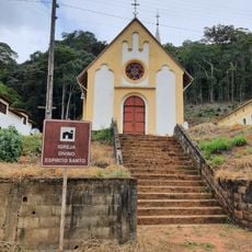
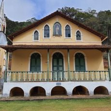
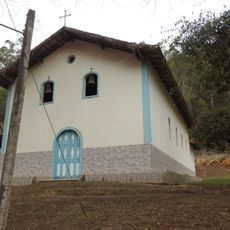
German settlers founded the Santa Isabel Colony in 1846 and built a chapel on Serra da Boa Vista in 1847. About two decades later, a Lutheran church was constructed in 1866, becoming Brazil's first evangelical church with a bell tower.

German settlers shaped the region, leaving visible marks in buildings like the Lutheran church from 1866 and in how people maintain traditional crafts. The way locals produce food and live reflects the heritage brought by these early immigrants.

Visitors can reach the different districts by road, with connections heading toward the state capital Vitória. The mountain location means you should allow extra time for travel and be prepared for changing weather conditions depending on the season.

Local farms produce artisanal goods like cheese, liqueurs, and traditional sweets that visitors can purchase directly. These homemade products give a real taste of the region's food culture and handcraft traditions.

The community of curious travelers

AroundUs brings together thousands of curated places, local tips, and hidden gems, enriched daily by 60,000 contributors worldwide.

Start exploring
Location
Elevation above the sea
730 m
Shares border with
Santa Maria de Jetibá, Venda Nova do Imigrante, Vargem Alta, Marechal Floriano, Viana
GPS coordinates
-20.36278,-40.65889
Latest update
December 20, 2025 12:53
« Domingos Martins - Mountain municipality in Espirito Santo, Brazil » is provided by Around Us (aroundus.com). Images and texts are derived from Wikimedia project under a Creative Commons license. You are allowed to copy, distribute, and modify copies of this page, under the conditions set by the license, as long as this note is clearly visible.

Discover hidden gems everywhere you go!

From secret cafés to breathtaking viewpoints, skip the crowded tourist spots and find places that match your style. Our app makes it easy with voice search, smart filtering, route optimization, and insider tips from travelers worldwide. Download now for the complete mobile experience.

Around Us App Screenshot

A unique approach to discovering new places

Le Figaro

All the places worth exploring

France Info

A tailor-made excursion in just a few clicks

20 Minutes

Around Us
Travel Guide & Maps
Download

Send to your phone

QR Code
1

Open the camera app on your mobile.

2

Point at the QR code with your camera. A notification will appear.

3

Tap the notification to open the link.