Ji-Paraná

Log in to your account

AroundUs is a community-driven map of interesting places, built by curious explorers like you. It grows with every review, story, and photo you share.
Connect to save your favorite spots, contribute locations, and create personalized routes.
Continue with Google
Continue with Apple
Continue with X
Continue with Facebook
Continue with email
By continuing, you accept our Terms and Conditions and our Privacy Policy
Create an account
Add to collection
Map
Suggest a change
Share

Ji-Paraná, Regional economic center in Rondônia, Brazil

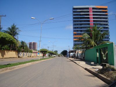
Ji-Paraná is a city of around 130,000 people in Rondônia state, where streets and neighborhoods spread along both banks of the river that shares its name. The two sides connect through several bridges that link the urban core with outlying areas where residential neighborhoods, markets, and public buildings sit.

Settlement started in the early 1970s when the Brazilian government launched programs to develop the northwest and attract pioneers from other states. Growth accelerated after 1977 when Ji-Paraná gained independent municipality status and evolved from a cluster of logging camps into a regional trade hub.

The name comes from the river itself and means "river of turtles" in the indigenous Tupi language, reflecting the region's connection to native vocabulary and wildlife. Many residents work in agriculture or trade, shaping daily life around livestock auctions and crop cycles that define the rhythm of this frontier town.

Travelers reach the city through José Coleto Airport or overland roads that connect it to other parts of Rondônia. Hotels, restaurants, and shops sit mostly in the central district, where most services are within walking distance.

A heart-shaped island forms where the Machado and Urupá rivers meet, earning the city its nickname Heart of Rondônia. Visitors can spot this natural feature from bridges or elevated viewpoints around the confluence zone.

Location: Rondônia

Elevation above the sea: 170 m

Shares border with: Vale do Anari, Presidente Médici, Colniza, Ministro Andreazza, Ouro Preto do Oeste, Rondolândia, Teixeirópolis, Theobroma, Urupá, Vale do Paraíso

Website: http://ji-parana.ro.gov.br

GPS coordinates: -10.88528,-61.95167

Latest update: December 13, 2025 19:27

Photos
Reviews

Visited this place? Tap the stars to rate it and share your experience / photos with the community! Try now! You can cancel it anytime.

« Ji-Paraná - Regional economic center in Rondônia, Brazil » is provided by Around Us (aroundus.com). Images and texts are derived from Wikimedia project under a Creative Commons license. You are allowed to copy, distribute, and modify copies of this page, under the conditions set by the license, as long as this note is clearly visible.

Discover hidden gems everywhere you go!

From secret cafés to breathtaking viewpoints, skip the crowded tourist spots and find places that match your style. Our app makes it easy with voice search, smart filtering, route optimization, and insider tips from travelers worldwide. Download now for the complete mobile experience.

Around Us App Screenshot

A unique approach to discovering new places

Le Figaro

All the places worth exploring

France Info

A tailor-made excursion in just a few clicks

20 Minutes