Cacoal, Administrative division in Rondônia, Brazil
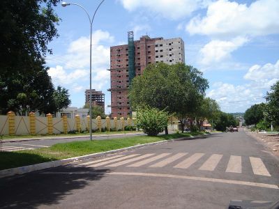
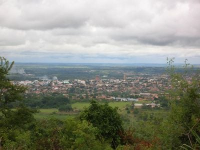
Cacoal extends across 3,792 square kilometers of land in western Brazil, positioned at coordinates -11.4333 latitude and -61.4420 longitude.
The settlement began forming in the 1960s alongside the BR-364 highway construction, with José Cassimiro Lopes establishing the first permanent structure for travelers.
The municipality holds regular agricultural festivals that connect local farmers, producers, and residents while showcasing regional products and traditions.
The city maintains direct flight connections through Cacoal Airport, with regular service to major regional destinations operated by Azul Airlines.
The name originated from Marechal Cândido Rondon's observation of native cocoa trees growing near the Ji-Paraná River during early expeditions.
Location: Rondônia
Elevation above the sea: 200 m
Website: http://www.cacoal.ro.gov.br/
Shares border with: Mato Grosso, Castanheiras, Espigão d'Oeste, Ministro Andreazza, Pimenta Bueno, Presidente Médici, Rolim de Moura, Rondolândia
Website: http://cacoal.ro.gov.br
GPS coordinates: -11.43861,-61.44722
Latest update: May 26, 2025 21:33
Madeira-Mamoré Railroad
401.4 km
Fort Prince of Beira
342.3 km
Noel Kempff Mercado National Park
317.5 km
Pacaás Novos National Park
218.7 km
Catarata Arco Iris
266.3 km
Urubichá
430.7 km
Serra Ricardo Franco State Park
374 km
Campos Amazônicos National Park
322.4 km
Cachoeira do Jatobá
414.8 km
Ríos Blanco y Negro Wildlife Reserve
385.9 km
Mapinguari National Park
459.6 km
Casarabe culture
504 km
Bajo Paraguá Municipal Protected Area
341.7 km
Rio Cautário Federal Extractive Reserve
304 km
Aquariquara Extractive Reserve
199.3 km
Association of Machadinho Rubber Tappers
232.1 km
Lago do Cuniã Extractive Reserve
414.5 km
Federico Ahlfeld Falls
263.1 km
Ruins of the Church of the Holy Trinity
429 km
Rio Cautário State Extractive Reserve
317.4 km
Rio Ouro Preto Extractive Reserve
363 km
Isla Cumprida
210.5 km
Madeira-Mamoré Railroad, rail yard
401.6 km
Castanheira do Estádio Aluízio Pinheiro Ferreira
402.4 km
Capela de Santo Antônio de Pádua
400.8 km
Três Caixas d'Água
401.8 km
Indigenous Territory Tenharim do Igarapé Preto
329.6 km
Prédio da Administração Central da EFMM
401.6 kmReviews
Visited this place? Tap the stars to rate it and share your experience / photos with the community! Try now! You can cancel it anytime.
Discover hidden gems everywhere you go!
From secret cafés to breathtaking viewpoints, skip the crowded tourist spots and find places that match your style. Our app makes it easy with voice search, smart filtering, route optimization, and insider tips from travelers worldwide. Download now for the complete mobile experience.
A unique approach to discovering new places❞
— Le Figaro
All the places worth exploring❞
— France Info
A tailor-made excursion in just a few clicks❞
— 20 Minutes