Guajará-Mirim, Border municipality in Rondônia, Brazil.
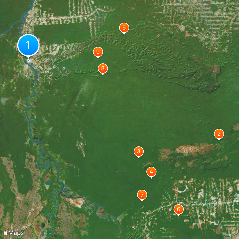
Guajará-Mirim sits on the Mamoré River border and extends across a large area of western Brazil. The municipality is surrounded by protected natural areas, including the Traçadal Biological Reserve, which shapes the landscape around it.
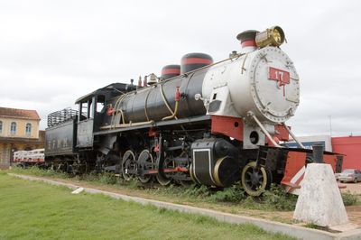
The Madeira-Mamoré Railway, completed in 1912, made this settlement a key connection point between Brazil and Bolivia. The railway marked a turning point for linking this border region to wider commerce and transport networks.
The city serves as a meeting point between Brazilian and Bolivian communities, where daily cross-border interactions shape daily life. People from both sides use the river crossing to trade and connect, giving the place a distinctly binational character.
The dry season offers the most accessible travel conditions for getting around and exploring the surrounding areas. Visitors should prepare for tropical weather and may want to arrange local guides to navigate the protected zones effectively.
A free trade zone established in 1993 opened the city to regional commerce in rubber, timber, and palm oil. This trading area attracts merchants from both sides of the border and shapes the economic character of the place.
Location: Rondônia
Elevation above the sea: 128 m
Shares border with: Campo Novo de Rondônia, Costa Marques, Governador Jorge Teixeira, Nova Mamoré, São Miguel do Guaporé, Seringueiras
Website: http://guajaramirim.ro.gov.br
GPS coordinates: -10.78278,-65.33944
Latest update: December 6, 2025 22:08
Madeira-Mamoré Railroad
273.7 km
Fort Prince of Beira
208.6 km
Palácio Rio Branco
285 km
Beni Biological Station Biosphere Reserve
410.7 km
Pacaás Novos National Park
212.9 km
Iturralde Crater
324.3 km
Museu da Borracha Governador Geraldo Mesquita
285.1 km
Estádio José de Melo
285 km
Mapinguari National Park
274.1 km
Municipal Protected Area Pampas of the Yacuma River
382.3 km
Ituxi Extractive Reserve
324 km
Rio Cautário Federal Extractive Reserve
170.9 km
Aquariquara Extractive Reserve
376.2 km
Association of Machadinho Rubber Tappers
396.2 km
Iquiri National Forest
273.9 km
Lago do Cuniã Extractive Reserve
342.4 km
Rio Cautário State Extractive Reserve
181.4 km
Rio Ouro Preto Extractive Reserve
70.3 km
Isla Cumprida
417.5 km
Seringal Bom Destino
268.5 km
Madeira-Mamoré Railroad, rail yard
273.9 km
Castanheira do Estádio Aluízio Pinheiro Ferreira
274.5 km
Capela de Santo Antônio de Pádua
267.8 km
Três Caixas d'Água
274.3 km
Cine Teatro Recreio
284.7 km
José Ballivián
453.5 km
Prédio da Administração Central da EFMM
274 km
Cathedral of the Holy Trinity
453.6 kmVisited this place? Tap the stars to rate it and share your experience / photos with the community! Try now! You can cancel it anytime.
Discover hidden gems everywhere you go!
From secret cafés to breathtaking viewpoints, skip the crowded tourist spots and find places that match your style. Our app makes it easy with voice search, smart filtering, route optimization, and insider tips from travelers worldwide. Download now for the complete mobile experience.
A unique approach to discovering new places❞
— Le Figaro
All the places worth exploring❞
— France Info
A tailor-made excursion in just a few clicks❞
— 20 Minutes