Humaitá, Municipality in Amazonas, Brazil.
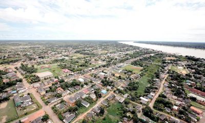
Humaitá is a municipality that spreads along the Madeira River, surrounded by dense Amazon rainforest and numerous waterways. The town sits in a flat area about 300 feet (90 meters) above sea level and serves as a transportation hub for several regions.
Founded in 1890 as a small riverside settlement, the city grew into a significant transportation hub for the Amazon region. This development was driven by its location at the intersection of multiple transport routes.
Local traditions blend indigenous customs with colonial influences that you can see in community celebrations and daily life. This mix shapes how people here connect with their surroundings and each other.
The Trans-Amazonian Highway runs through the city and connects it to other locations in the region, while a local airport offers flights to other parts of Brazil. Plan your visit during the dry season when roads are more passable and travel is easier.
Part of the territory includes sections of Campos Amazônicos National Park, where grassland vegetation grows within the rainforest and creates unusual ecological zones. This mix of different plant communities makes the area ecologically distinctive.
Location: Amazonas
Inception: 1890
Elevation above the sea: 61 m
Shares border with: Manicoré, Canutama, Machadinho d'Oeste, Porto Velho, Tapauá
Website: http://humaita-am.com
GPS coordinates: -7.50611,-63.02083
Latest update: December 17, 2025 09:12
Humaitá National Forest
0 mBalata-Tufari National Forest
107.5 kmCuniã Ecological Station
69 kmCampos de Manicoré Environmental Protection Area
197.3 kmJacundá National Forest
100.5 km
Lago do Cuniã Extractive Reserve
103 kmTapauá State Forest
126.3 kmCachoeira Palmeiras
133.2 kmCachoeira Manoa
146.4 kmCachoeira Jaquirana
135.1 kmCachoeira do Samuel
146.9 kmCachoeira do Remo
138.8 kmCachoeira Candelária
179.4 kmCachoeira Lava-Cara
181.5 kmCachoeira Dois de Novembro
172.8 kmCachoeira São Vicente
176.9 kmCachoeira Paricá
147.5 kmCachoeira Caixão
131.1 kmCachoeira Jutaí
125.6 kmCachoeira da Anta
129.2 kmCachoeira Periquitos
131.2 kmCastelinho de Humaitá
350 mFazenda Ecológica JL
129.5 kmBauneário Paraíso do Bené
153.5 kmBauneário da Jacutinga
150.3 kmSão Francisco de Assis
1.7 kmBusto Ferreira de Castro
40 mBusto Francisco Monteiro
39 mVisited this place? Tap the stars to rate it and share your experience / photos with the community! Try now! You can cancel it anytime.
Discover hidden gems everywhere you go!
From secret cafés to breathtaking viewpoints, skip the crowded tourist spots and find places that match your style. Our app makes it easy with voice search, smart filtering, route optimization, and insider tips from travelers worldwide. Download now for the complete mobile experience.
A unique approach to discovering new places❞
— Le Figaro
All the places worth exploring❞
— France Info
A tailor-made excursion in just a few clicks❞
— 20 Minutes