Enable Location

We need your location to show you interesting places around you

Discover nearby places

Find interesting locations and hidden gems around you

Precise directions

Get accurate directions and distances to places

Your location is never shared with other users. It's only used when you tap the location button.

Rondonópolis

Log in to your account

Start exploring — it's free

Trusted by 62,832 travelers worldwide

Continue with Google
Continue with Apple
or

We will send you a code to connect

By continuing, you accept our Terms and Conditions and our Privacy Policy

Check your inbox

We've sent a pincode in your inbox. Please enter the code below.

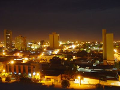
Rondonópolis, Agricultural hub in Mato Grosso, Brazil.

Rondonópolis is a municipality in Mato Grosso state, covering more than 10,700 square kilometers and located roughly 215 kilometers from the capital Cuiabá. The city sits around 227 meters above sea level and forms a major center for agricultural trade in the region.

The municipality was founded in 1953 and received its name from military explorer Cândido Rondon, who led expeditions through the area. Development accelerated in the following decades with the expansion of transport routes and the rise of agricultural production.

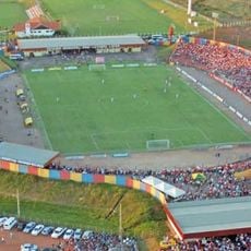
The annual Exposul agricultural fair gathers farmers, manufacturers, and residents who present regional products and technological advances. Visitors experience the region's strong connection to modern farming and can meet producers directly.

The municipal airport Maestro Marinho Franco connects the place with domestic flights, while major highways provide access to surrounding regions. Travelers find hotels and shops mostly in the city center, where most services are concentrated.

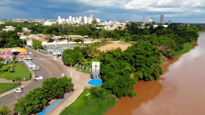
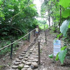
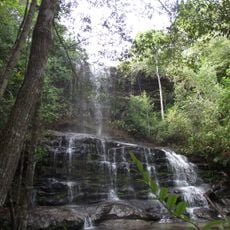
The Vermelho River flows through the southern part of the city and marks the northern border of Dom Osório Stoffel State Park. Proximity to this protected area offers visitors a chance to explore natural landscapes after time spent in the city.

The community of curious travelers

AroundUs brings together thousands of curated places, local tips, and hidden gems, enriched daily by 60,000 contributors worldwide.

Start exploring
Location
Inception
December 10, 1953
Elevation above the sea
227 m
Shares border with
Juscimeira, Itiquira, Pedra Preta, Poxoréu, Santo Antônio de Leverger, São José do Povo
GPS coordinates
-16.47083,-54.63583
Latest update
December 13, 2025 16:01
« Rondonópolis - Agricultural hub in Mato Grosso, Brazil » is provided by Around Us (aroundus.com). Images and texts are derived from Wikimedia project under a Creative Commons license. You are allowed to copy, distribute, and modify copies of this page, under the conditions set by the license, as long as this note is clearly visible.

Discover hidden gems everywhere you go!

From secret cafés to breathtaking viewpoints, skip the crowded tourist spots and find places that match your style. Our app makes it easy with voice search, smart filtering, route optimization, and insider tips from travelers worldwide. Download now for the complete mobile experience.

Around Us App Screenshot

A unique approach to discovering new places

Le Figaro

All the places worth exploring

France Info

A tailor-made excursion in just a few clicks

20 Minutes

Around Us
Travel Guide & Maps
Download

Send to your phone

QR Code
1

Open the camera app on your mobile.

2

Point at the QR code with your camera. A notification will appear.

3

Tap the notification to open the link.