Santarém

Log in to your account

AroundUs is a community-driven map of interesting places, built by curious explorers like you. It grows with every review, story, and photo you share.
Connect to save your favorite spots, contribute locations, and create personalized routes.
Continue with Google
Continue with Apple
Continue with X
Continue with Facebook
Continue with email
By continuing, you accept our Terms and Conditions and our Privacy Policy
Create an account
Add to collection
Map
Suggest a change
Share

Santarém, Regional administrative hub in Pará, Brazil.

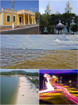
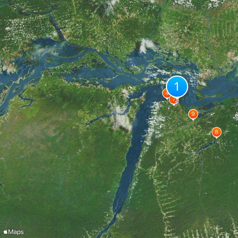
Santarém is a municipality and major settlement at the meeting of the Tapajós and Amazon rivers in northern Brazil, sitting on a narrow strip of land that separates the two waterways. The built area extends from the dense historic center to scattered neighborhoods along the shores, with sandy beaches and floating houses reflecting the changing water levels.

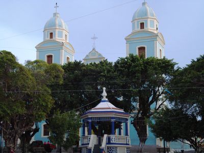
A Jesuit priest built a chapel here in 1661, around which a small settlement formed, initially called Aldeia do Tapajós. The renaming came later after a town in Portugal, and the place grew gradually through river trade and rubber industry into a regional center.

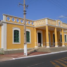
The city takes its name from a Portuguese town, a colonial link still visible in street names and religious celebrations. Visitors can taste local dishes made from Amazon fish at the river beaches and watch fishing boats return in the late afternoon.

A visit works best during the dry season from August to December, when river shores widen and moving around the center becomes easier. Motorcycle taxis and small boats connect the different neighborhoods, and it is wise to carry a waterproof bag for trips on the water.

The two rivers meet here without blending, so that clear greenish water from the Tapajós runs alongside the murky brown Amazon. This phenomenon continues for several kilometers downstream and is best observed from a boat.

Location: Pará

Inception: June 22, 1661

Elevation above the sea: 60 m

Shares border with: Alenquer, Aveiro, Curuá, Monte Alegre, Juruti, Mojuí Dos Campos, Uruará, Prainha, Óbidos

Website: http://santarem.pa.gov.br

GPS coordinates: -2.44278,-54.70778

Latest update: December 15, 2025 06:21

Photos
Reviews

Visited this place? Tap the stars to rate it and share your experience / photos with the community! Try now! You can cancel it anytime.

« Santarém - Regional administrative hub in Pará, Brazil » is provided by Around Us (aroundus.com). Images and texts are derived from Wikimedia project under a Creative Commons license. You are allowed to copy, distribute, and modify copies of this page, under the conditions set by the license, as long as this note is clearly visible.

Discover hidden gems everywhere you go!

From secret cafés to breathtaking viewpoints, skip the crowded tourist spots and find places that match your style. Our app makes it easy with voice search, smart filtering, route optimization, and insider tips from travelers worldwide. Download now for the complete mobile experience.

Around Us App Screenshot

A unique approach to discovering new places

Le Figaro

All the places worth exploring

France Info

A tailor-made excursion in just a few clicks

20 Minutes