Luis Eduardo Magalhaes, Municipality in western Bahia, Brazil
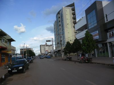
Luis Eduardo Magalhaes is a municipality in western Bahia spread across a wide agricultural area at an elevation of around 720 meters (2,360 feet). The settlement includes several educational institutions and is home to Brazil's largest soy processing facility.
The municipality originated in the 1990s from a simple gas station and received its official status as an independent commune in 1995. Its rapid growth was closely tied to the expansion of agriculture into the Cerrado region.
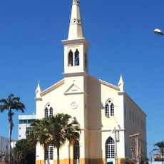
The town takes its name from a Brazilian politician and shows the clear influence of migration from southern regions in everyday life. Visitors quickly notice the agricultural character, as fields and silos are everywhere and shape the urban landscape.
The area lies far from the largest cities in Bahia, so having your own vehicle is recommended for arrival and exploration. Roads are mostly paved, but distances between locations can be large.
The municipality ranks among the youngest in Brazil and emerged only about three decades ago in a region that was barely settled before. The tropical highland climate influence makes nighttime temperatures noticeably cooler than in other parts of Bahia.
Location: Bahia
Elevation above the sea: 720 m
Shares border with: Barreiras, São Desidério, Aurora do Tocantins, Ponte Alta do Bom Jesus, Taguatinga
Website: http://luiseduardomagalhaes.ba.gov.br
GPS coordinates: -12.09194,-45.80500
Latest update: December 12, 2025 23:40
Barragem de Contenção de Rejeitos
141.8 kmATS 11
121.3 kmMuseu Municipal Napoleão de Mattos Macêdo
88.3 kmSerra da Taguatinga
74.2 kmPouso Alto I
121.2 kmATS 10
128 kmVitória
139 kmEstiva
132.1 kmCachoeira Redonda
45.1 kmAgronol-01
18.9 kmRio Limpo
29.6 kmQuilombo Lajeado
114.6 km
Cathedral of St John the Baptist in Barreiras
87.9 kmMuseu Municipal Olavo Pereira dos Santos
95.4 kmMemorial Cidade Luis Eduardo Magalhães
1.3 kmFortaleza dos Guardiões
122.2 kmAcesso à Cachoeira da Ré
110.8 kmAcesso à Cachoeira da Ré
110.8 kmAzuis
85.1 kmMirante do poste
89.7 kmCachoeira do Acaba-vida
31.3 kmPegar a trilha da direita
49.3 kmSaída/entrada para escarpa
49.4 kmSaída
50.3 kmCachoeira do Redondo
46.3 kmCachoeira do Ouro
74.1 kmCachoeira do Cansado
51.6 kmVisited this place? Tap the stars to rate it and share your experience / photos with the community! Try now! You can cancel it anytime.
Discover hidden gems everywhere you go!
From secret cafés to breathtaking viewpoints, skip the crowded tourist spots and find places that match your style. Our app makes it easy with voice search, smart filtering, route optimization, and insider tips from travelers worldwide. Download now for the complete mobile experience.
A unique approach to discovering new places❞
— Le Figaro
All the places worth exploring❞
— France Info
A tailor-made excursion in just a few clicks❞
— 20 Minutes