Barreiras, Administrative division in western Bahia, Brazil
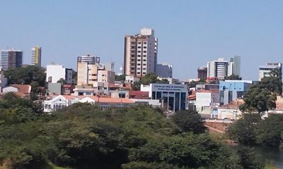
Barreiras is a city in western Bahia state, Brazil, serving as the economic and political hub of this region. It spreads across a wide area with several neighborhoods connected by main roads and a regular street grid.
The area was originally inhabited by indigenous peoples before European settlers arrived in the late 19th century. Following settlement, the place slowly grew into an agricultural center that expanded rapidly in the 1970s through irrigation projects.
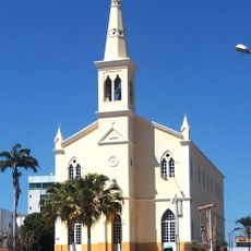
Residents call the place "Gateway to the Cerrado" and maintain a local heritage visible in the eating habits and music of rural communities. Many families gather regularly in public squares downtown, where you can observe the relaxed pace of daily life along smaller side streets.
The place is best reached by car or bus, as it sits along several long-distance highways. Visitors arriving here will find a warm climate year-round and should plan for long daytime drives if exploring surrounding areas.
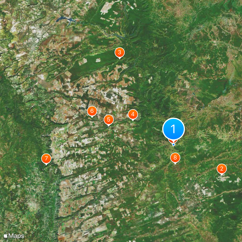
In the outskirts you can see fields that reach to the horizon and glow in different shades of green and yellow during harvest season. This agricultural landscape shapes the cityscape more than historic buildings or old monuments.
Location: Bahia
Inception: 1891
Elevation above the sea: 454 m
Shares border with: Luis Eduardo Magalhaes, Catolândia, Angical, Baianópolis, Riachão das Neves, Dianópolis, Formosa do Rio Preto, Novo Jardim, Ponte Alta do Bom Jesus, São Desidério
Website: http://barreiras.ba.gov.br
GPS coordinates: -12.15278,-44.99000
Latest update: December 12, 2025 22:58
Cristópolis National Forest
69.7 kmCachoeira do Estrondo
125.2 kmCachoeira Redonda
58.4 kmAgronol-01
83.3 kmRio Limpo
105.9 kmSerra da Taguatinga
157.9 kmSão Desidério
23.3 kmMuseu Municipal Napoleão de Mattos Macêdo
772 mQuilombo Mucambo
5.8 kmQuilombo Lajeado
198.8 kmMuseu Municipal Olavo Pereira dos Santos
23.8 kmMemorial Cidade Luis Eduardo Magalhães
88.8 km
Cathedral of St John the Baptist in Barreiras
1.1 kmAzuis
161.2 kmBifurcação - pegar à direita
133.2 kmAcesso à Cachoeira da Ré
195.1 kmAcesso à Cachoeira da Ré
195.2 kmAcesso à Cachoeira da Ré
195.2 kmCachoeira do Acaba-vida
72.6 kmCachoeira do Estrondo
126.6 kmAssociação Atlética Banco do Brasil
51.9 kmPegar estrada à direita
136.9 kmPegar a trilha da direita
136.9 kmSaída/entrada para escarpa
137 kmSaída
137.8 kmCachoeira do Redondo
56.7 kmCachoeira do Ouro
104.6 kmCachoeira do Cansado
139.3 kmVisited this place? Tap the stars to rate it and share your experience / photos with the community! Try now! You can cancel it anytime.
Discover hidden gems everywhere you go!
From secret cafés to breathtaking viewpoints, skip the crowded tourist spots and find places that match your style. Our app makes it easy with voice search, smart filtering, route optimization, and insider tips from travelers worldwide. Download now for the complete mobile experience.
A unique approach to discovering new places❞
— Le Figaro
All the places worth exploring❞
— France Info
A tailor-made excursion in just a few clicks❞
— 20 Minutes