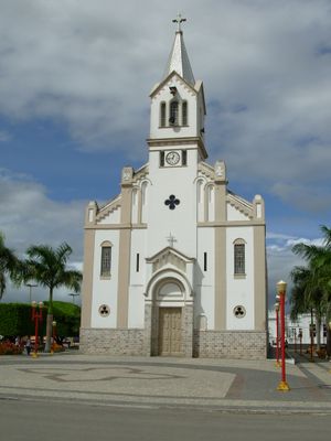
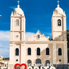
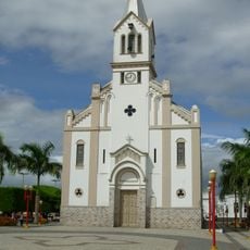
Simão Dias, Municipality in western Sergipe, Brazil
Simão Dias is a municipality in western Sergipe, Brazil, covering a territory of varied terrain with hills and elevated areas. The landscape shifts from lower to higher ground, shaping how the region looks and feels.
The area was originally settled by Tapuia tribes living along the Rio Caiçá river. The municipality received its official status in 1890 following a decree from the state leadership.
The municipality celebrates its culture through annual festivals in June featuring music and traditional dances that bring the community together. These gatherings reflect the local way of life and how residents mark their identity.
The municipality is best visited when weather conditions are favorable and roads are easily accessible. Local guides and information can be found at the municipal administration office.
During the Dutch invasion of the region in the 1600s, local farmers hid their cattle in river valleys to protect them from raiders. This survival strategy shows how early residents used the landscape to keep their livestock safe.
Location: Sergipe
Elevation above the sea: 263 m
Shares border with: Paripiranga, Poço Verde, Pinhão, Lagarto, Pedra Mole, Riachão do Dantas, Tobias Barreto
Website: http://simaodias.se.gov.br
GPS coordinates: -10.73778,-37.81083
Latest update: December 7, 2025 10:05
São Francisco Square in the Town of São Cristóvão
73 km
Serra de Itabaiana National Park
50.7 km
Parish Church of Our Lady of Victory
72.7 km
Parque dos Falcões
47.5 km
Chapel of Our Lady of the Conception of Engenho Poxim
65 km
Church of Sant'Aninha
71.1 km
Chapel of the Nossa Senhora da Penha Sugar Plantation
63.5 km
Capela do Engenho Nossa Senhora da Penha
63.5 km
Igreja de Nossa Senhora da Conceição dos Pardos (Laranjeiras)
70.6 km
Primeira Igreja Presbiteriana de Sergipe
70.8 km
Teatro São Pedro
70.6 km
Fachadas Revestidas de Azulejos Portugueses--Rua Capitão Salomão nº. 67
71.9 km
Capela do Antigo Engenho Jesus, Maria e José
66.9 km
Igreja da Ordem Terceira do Carmo (São Cristóvão)
72.9 km
Church and Convent of Mount Carmel
72.9 km
Architectural and Landscape Ensemble of Laranjeiras, Sergipe
70.8 km
Igreja de Nossa Senhora do Rosário
71.9 km
Sobrado at Rua da Matriz
72.9 km
Cine Laser Itabaiana
42.4 km
Architectural, Urban and Landscape Set of São Cristóvão
73 km
Igreja do Bom Jesus dos Navegantes
71.2 km
Mother Church of Nossa Senhora da Boa Hora and São Roque (Campo do Brito/SE)
34.7 km
Former Police Station of Laranjeiras
70.6 km
Museu Afro-Brasileiro de Sergipe
70.5 km
Igreja Matriz de Senhora Santana
224 m
Colégio Estadual Professora Zizinha Guimarães
70.8 km
Casa do Folclore "Zeca de Norberto"
72.9 km
Rua Messias Prado, 20
72.9 kmVisited this place? Tap the stars to rate it and share your experience / photos with the community! Try now! You can cancel it anytime.
Discover hidden gems everywhere you go!
From secret cafés to breathtaking viewpoints, skip the crowded tourist spots and find places that match your style. Our app makes it easy with voice search, smart filtering, route optimization, and insider tips from travelers worldwide. Download now for the complete mobile experience.
A unique approach to discovering new places❞
— Le Figaro
All the places worth exploring❞
— France Info
A tailor-made excursion in just a few clicks❞
— 20 Minutes