Estância, Municipality in Sergipe, Brazil
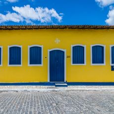
Estância is a municipality in Sergipe state, Brazil, situated roughly 66 kilometers from the coastal capital. The town features colonial-style architecture and serves as an administrative center for the surrounding agricultural region.
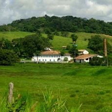
The settlement began in 1621 when land was granted for cattle raising purposes. This early pastoral economy shaped regional development for centuries to come.
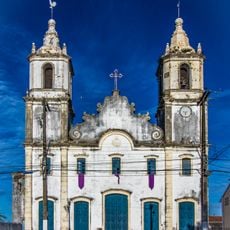
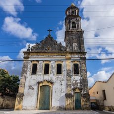
The Igreja de Nossa Senhora de Guadalupe bears Mexican architectural influences that set it apart from other regional places of worship. Residents regard this church as a gathering place for community celebrations and religious traditions.
Visiting is feasible year-round in this warm, humid climate. Comfortable footwear matters for walking through town, and bringing sun protection is wise.
An emperor once compared the town to a garden because of its tiled houses and verdant surroundings. This royal praise remains part of the local identity today.
The community of curious travelers
AroundUs brings together thousands of curated places, local tips, and hidden gems, enriched daily by 60,000 contributors worldwide.