Petrolândia, Municipality in São Francisco Region, Pernambuco, Brazil.
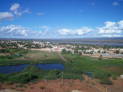
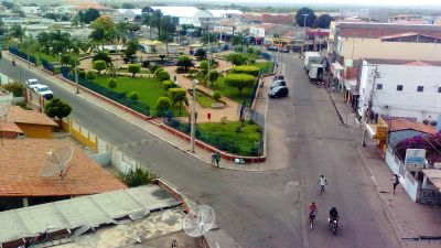
Petrolândia is a municipality in the São Francisco Region of Pernambuco, stretching across semi-arid terrain where coconuts, bananas, and guava are grown. The area sits at around 280 meters elevation and is connected by roads linking it to larger coastal cities.
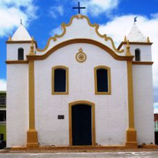
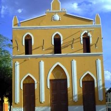
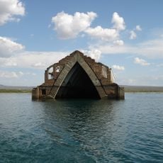
The settlement was originally known as Jatobá, then renamed Itaparica between 1939 and 1943, before taking its current name honoring Emperor Dom Pedro II. These name changes reflect the shifting history of settlement in the Sertão region.
The region holds memories of the Kambiwá people, an indigenous group whose language was once spoken in Barreira and reflects the deep connection of the place to its original inhabitants.
The best time to visit is during the cooler months from June to August, when temperatures are more pleasant. The region is easily accessible by road, and visitors should prepare for heat and remember that lodging and dining options may be limited.
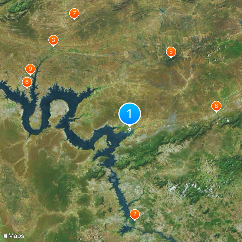
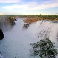
A hydroelectric power plant operated by CHESF feeds power into the regional grid and contributes significantly to the area's prosperity. This facility is one of the reasons why the local economy is stronger compared to other places in the Sertão.
Location: Pernambuco
Elevation above the sea: 282 m
Shares border with: Floresta, Glória, Jatobá, Rodelas, Tacaratu
Website: http://petrolandia.pe.gov.br
GPS coordinates: -8.97917,-38.21944
Latest update: December 20, 2025 11:30
Paulo Afonso Falls
45.7 km
Igreja de Nossa Senhora do Rosário
56.9 kmSerra Negra Biological Reserve
41.7 kmCaatinga Ecological Corridor
41.7 kmObservatório Astronômico do Sertão de Itaparica
55.6 kmCantidiano Valqueiro Barros Private Natural Heritage Reserve
62 km
Igreja Santo Antônio de Pádua
44.6 kmQuilombo Poço dos Cavalos
57 kmMandantes - PISF
34.2 kmCachoeira Itaparica
17.2 kmQuilombo Enjeitado
44.3 kmQuilombo Borda do Lago
1.4 kmQuilombo Ingazeira
58.4 kmSalgueiro - PISF
37.5 kmQuilombo Lagoa das Pedras
42.5 km
Old Petrolandia Church
6.9 kmQuilombo Negros do Pajeú
56.9 kmQuilombo Sítio Queimadas
43.4 kmAreias - PISF
30.6 kmPariconha
39 kmDelmiro Gouveia
42.5 kmQuilombo Poço Dantas
44.1 kmBraúnas - PISF
31.9 kmQuilombo Melancia
37 kmQuilombo Burnil
38.8 kmMuseu Casa de Maria Bonita
46 kmQuilombo Negros de Gilú
60 kmQuilombo Malhada Vermelha
39.7 kmVisited this place? Tap the stars to rate it and share your experience / photos with the community! Try now! You can cancel it anytime.
Discover hidden gems everywhere you go!
From secret cafés to breathtaking viewpoints, skip the crowded tourist spots and find places that match your style. Our app makes it easy with voice search, smart filtering, route optimization, and insider tips from travelers worldwide. Download now for the complete mobile experience.
A unique approach to discovering new places❞
— Le Figaro
All the places worth exploring❞
— France Info
A tailor-made excursion in just a few clicks❞
— 20 Minutes