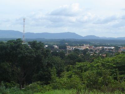
Xinguara, Agricultural municipality in Pará, Brazil.
Xinguara is a municipality in northern Brazil, situated on flat to gently rolling terrain dominated by agricultural land. The settlement has a straightforward layout with a town center that serves as a supply point for farmers and surrounding villages.
The municipality grew out of Brazil's agricultural expansion in the 1960s, when land development programs brought farming to previously unsettled areas of Pará. Settlement initiatives transformed forest into productive farmland across the region.
Local farming fairs and community celebrations display regional harvests and connect neighboring villages through shared agricultural interests. These gatherings shape the social rhythm of daily life and show how farming is central to the identity of people here.
The local airport connects to larger cities in the region, while several highways link the municipality to major centers across Pará. Visitors should expect basic infrastructure and longer travel times when moving between towns.
The area serves as a crucial trading hub where farmers from surrounding regions bring cattle and crops to consolidate before shipping to larger cities. This role as a gathering point makes it a place where you can witness how local commerce actually operates.
The community of curious travelers
AroundUs brings together thousands of curated places, local tips, and hidden gems, enriched daily by 60,000 contributors worldwide.