Chest opened
+${chestReward.xp} XP
Explorer
NOUVEAU ×${chestReward.collectible.quantity}
tapez pour fermer

See the monuments around you in AR Open chests in the app

Around Us is built for your phone — point your camera at the streets and discover the monuments and places around you in augmented reality. Around Us is built for your phone — chests unlock when you walk, explore and capture nearby places.

•

Enable Location

We need your location to show you interesting places around you

Discover nearby places

Find interesting locations and hidden gems around you

Precise directions

Get accurate directions and distances to places

Your location is never shared with other users. It's only used when you tap the location button.

Upemba National Park

Log in to your account

Start exploring — it's free

Trusted by 94,073 travelers worldwide

Continue with Google
Continue with Apple
or

We will send you a code to connect

By continuing, you accept our Terms and Conditions and our Privacy Policy

Check your inbox

We've sent a pincode in your inbox. Please enter the code below.

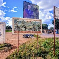
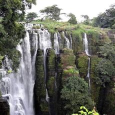
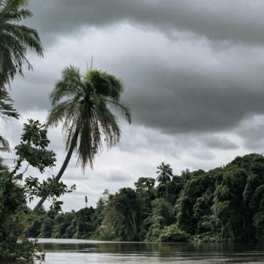
Upemba National Park, National park in Haut-Katanga Province, Democratic Republic of Congo

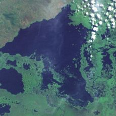
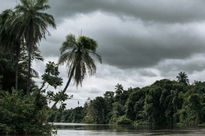
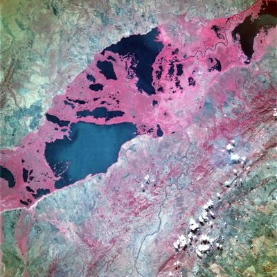
Upemba National Park covers 11,730 km² across the Kibara Plateau at 1,750–1,800 m and the Kamalondo Depression, where Lake Upemba and Lake Kisale lie. The Lualaba River borders it to the west. Its wetlands, floodplains, miombo woodlands and dry savannas form part of the Central Zambezian Miombo ecoregion.

The park was established in 1939 and initially represented one of Africa's largest protected areas. Since its creation, its focus has centered on safeguarding these landscapes and their inhabitants.

The park contains a handful of villages, and its management has been run since 2017 by the NGO Forgotten Parks under a fifteen-year partnership with the Congolese government agency. Christine Lain leads this partnership. She links attacks on the park to illegal groups opposed to closer ties between park managers and local communities.

The best visiting period depends on water levels, which reach their highest between March and June. During the dry season from October to January, expect significantly lower water levels throughout the park.

Lake Upemba reaches a maximum depth of only 3.2 metres, and its water level follows the seasons: high from March to June, low from October to January. The surrounding swamps hold papyrus, Nile lettuce and water caltrop, and the lake system shelters over 30 species of Cyprinidae alone.

The community of curious travelers

AroundUs brings together thousands of curated places, local tips, and hidden gems, enriched daily by 94,073 contributors worldwide.
Start exploring
Location
Kabanga
Address
Kabanga, Democratic Republic of the Congo
GPS coordinates
-8.98398,26.54121
Latest update
October 28, 2026 15:56
Around this place
Kundelungu National Park
Congo, Democratic Republic of the

Kundelungu National Park

83.3 mi
Lake Upemba
Congo, Democratic Republic of the

Lake Upemba

27 mi
Lake Kisale
Congo, Democratic Republic of the

Lake Kisale

51.5 mi
Congo, Democratic Republic of the

Chutes Mututuma

78.3 mi
Congo, Democratic Republic of the

Chutes Kawa

81.7 mi
Chute Kiubo
Congo, Democratic Republic of the

Chute Kiubo

50 mi
Congo, Democratic Republic of the

Chutes Sangwalumba

81.3 mi
Congo, Democratic Republic of the

Chutes Mwinda-Mwuta

79.8 mi
Congo, Democratic Republic of the

Chutes Kawanga

71 mi
Congo, Democratic Republic of the

Chute Fuka

69.7 mi
Congo, Democratic Republic of the

Chutes De Cinquante des Soixante m

76.7 mi
Congo, Democratic Republic of the

Chutes Dikolongo

80.6 mi
Congo, Democratic Republic of the

Chutes Dipera

70.1 mi
Congo, Democratic Republic of the

Chutes Kayo

70.2 mi
Congo, Democratic Republic of the

Chute 250 Metre

67.7 mi
Congo, Democratic Republic of the

Chute Kimimbi Fuka

70.9 mi
Congo, Democratic Republic of the

Chutes Lupata

70 mi
Congo, Democratic Republic of the

Waterfall

50.1 mi
Congo, Democratic Republic of the

Waterfall

24.5 mi
Congo, Democratic Republic of the

Waterfall

66.1 mi
Congo, Democratic Republic of the

Waterfall

64.9 mi
Congo, Democratic Republic of the

Waterfall

80.5 mi
Congo, Democratic Republic of the

Waterfall

98.4 mi
Congo, Democratic Republic of the

Waterfall

98.4 mi
Congo, Democratic Republic of the

Waterfall

25.1 mi
Congo, Democratic Republic of the

Waterfall

25.1 mi
Congo, Democratic Republic of the

Waterfall

25.3 mi
Congo, Democratic Republic of the

Waterfall

25.1 mi
Show the full map
Reviews
Share your experience

No review yet

Discussions
Start a discussion...

No discussion yet

« Upemba National Park - National park in Haut-Katanga Province, Democratic Republic of Congo » is provided by Around Us (aroundus.com). Images and texts are derived from Wikimedia project under a Creative Commons license. You are allowed to copy, distribute, and modify copies of this page, under the conditions set by the license, as long as this note is clearly visible.

Discover hidden gems everywhere you go!

From secret cafés to breathtaking viewpoints, skip the crowded tourist spots and find places that match your style. Our app makes it easy with voice search, smart filtering, route optimization, and insider tips from travelers worldwide. Download now for the complete mobile experience.

Around Us App Screenshot
❝

A unique approach to discovering new places❞

— Le Figaro

❝

All the places worth exploring❞

— France Info

❝

A tailor-made excursion in just a few clicks❞

— 20 Minutes

Around Us
Travel Guide & Maps
Download

Send to your phone

QR Code
1

Open the camera app on your mobile.

2

Point at the QR code with your camera. A notification will appear.

3

Tap the notification to open the link.