Democratic Republic of the Congo

Log in to your account

AroundUs is a community-driven map of interesting places, built by curious explorers like you. It grows with every review, story, and photo you share.
Connect to save your favorite spots, contribute locations, and create personalized routes.
Continue with Google
Continue with Apple
Continue with X
Continue with Facebook
Continue with email
By continuing, you accept our Terms and Conditions and our Privacy Policy
Create an account
Add to collection
Map
Suggest a change
Share

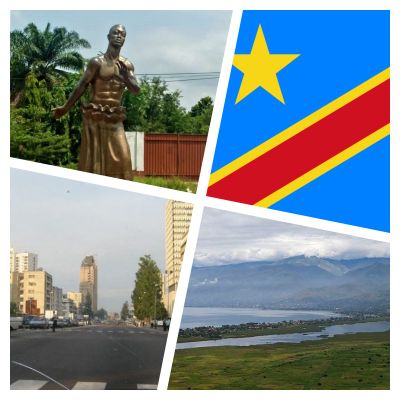
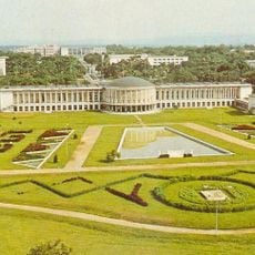
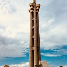
Democratic Republic of the Congo, Central African country in the Congo Basin

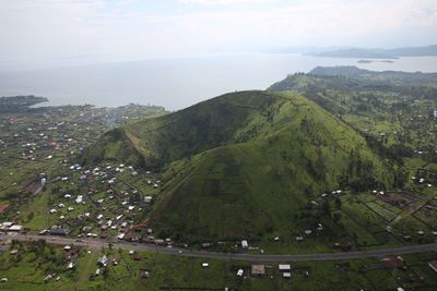
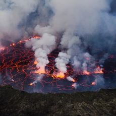
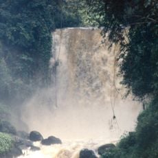
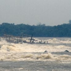
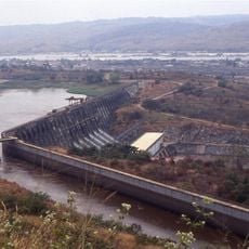
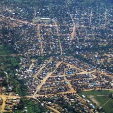
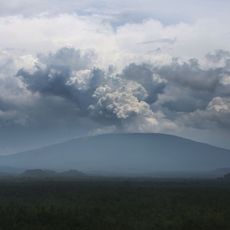
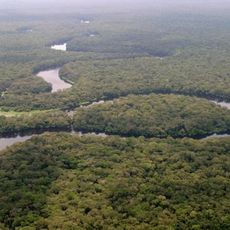
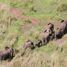
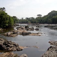
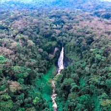
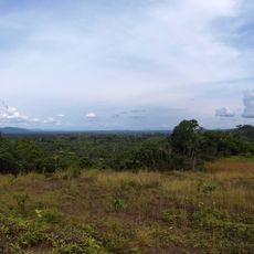
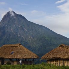
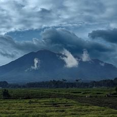
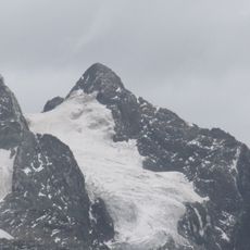
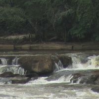
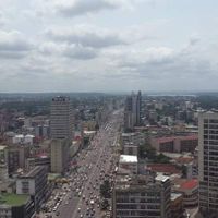
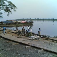
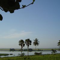
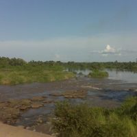
The Democratic Republic of the Congo is a central African nation in the Congo Basin that covers more than two million square kilometers and includes dense rainforest, mountain ranges, savannas, and the Congo River system. The landscape ranges from coastal lowlands in the west through extensive central forests to the Virunga Mountains in the east.

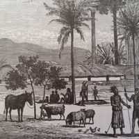
The territory gained independence from Belgium in 1960 after decades of colonial rule that started in 1885 with King Leopold II's personal control. Political instability and armed conflicts followed independence and led to major social and economic disruption during the late 20th and early 21st centuries.

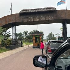
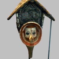
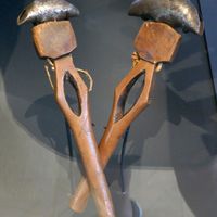
More than two hundred ethnic communities live here and each maintains its own rituals, crafts, and clothing styles that visitors can experience at local markets or village gatherings. Soukous and rumba music shape daily life in many towns, where rhythms spill from open windows and small bars and dance events continue late into the night.

Visitors need a visa from an embassy before entering, current vaccinations, and malaria prevention and should only travel with registered tour operators in stable regions. The dry seasons from May through September and December through February offer better travel conditions, though security situations should be checked before any trip.

The country holds eighty percent of the world's coltan reserves, essential for manufacturing electronic devices, along with major cobalt and copper deposits. Salonga National Park forms the largest protected rainforest area in Africa and shelters endangered bonobos found in the wild only here.

Location: Sankuru

Inception: June 30, 1960

Capital city: Kinshasa

Part of: Central Africa

Shares border with: Central African Republic, South Sudan, Uganda, Rwanda, Burundi, Tanzania, Zambia, Angola, Republic of the Congo, Sudan, Cameroon

GPS coordinates: -2.98143,23.82226

Latest update: December 14, 2025 17:35

Photos
Around this place
Mount Nyiragongo
Congo, Democratic Republic of the

Mount Nyiragongo

625.2 km
Virunga National Park
Congo, Democratic Republic of the

Virunga National Park

689.5 km
Boyoma Falls
Congo, Democratic Republic of the

Boyoma Falls

416.3 km
Martyrs' stadium
Congo, Democratic Republic of the

Martyrs' stadium

957.5 km
Inga Dams
Congo, Democratic Republic of the

Inga Dams

1167 km
Inga Falls
Congo, Democratic Republic of the

Inga Falls

1166.1 km
Stade Tata Raphaël
Congo, Democratic Republic of the

Stade Tata Raphaël

956.3 km
Bunia
Congo, Democratic Republic of the

Bunia

876.3 km
Nyamuragira
Congo, Democratic Republic of the

Nyamuragira

623.5 km
Palace of the Nation
Congo, Democratic Republic of the

Palace of the Nation

960.3 km
Tour de l'Échangeur de Limete
Congo, Democratic Republic of the

Tour de l'Échangeur de Limete

954.4 km
Congo

Brazzaville–Kinshasa Bridge

959.1 km
Salonga National Park
Congo, Democratic Republic of the

Salonga National Park

259.1 km
Garamba National Park
Congo, Democratic Republic of the

Garamba National Park

984.2 km
Nsele Valley Park
Congo, Democratic Republic of the

Nsele Valley Park

921.1 km
Okapi Wildlife Reserve
Congo, Democratic Republic of the

Okapi Wildlife Reserve

760.6 km
National Museum of the Democratic Republic of Congo
Congo, Democratic Republic of the

National Museum of the Democratic Republic of Congo

958.7 km
Palais du Peuple
Congo, Democratic Republic of the

Palais du Peuple

958.3 km
Kahuzi-Biéga National Park
Congo, Democratic Republic of the

Kahuzi-Biéga National Park

462.6 km
Maiko National Park
Congo, Democratic Republic of the

Maiko National Park

506.1 km
Mount Mikeno
Congo, Democratic Republic of the

Mount Mikeno

645.1 km
Matadi Bridge
Congo, Democratic Republic of the

Matadi Bridge

1195.5 km
Congo, Democratic Republic of the

Palais de Marbre

964.5 km
Congo, Democratic Republic of the

Kundelungu National Park

910.5 km
Mount Sabyinyo
Congo, Democratic Republic of the

Mount Sabyinyo

666.5 km
Margherita Peak
Congo, Democratic Republic of the

Margherita Peak

770.6 km
Congo, Democratic Republic of the

Lomami National Park

165.9 km
Upemba National Park
Congo, Democratic Republic of the

Upemba National Park

738 km
Show the full map
Reviews

Visited this place? Tap the stars to rate it and share your experience / photos with the community! Try now! You can cancel it anytime.

« Democratic Republic of the Congo - Central African country in the Congo Basin » is provided by Around Us (aroundus.com). Images and texts are derived from Wikimedia project under a Creative Commons license. You are allowed to copy, distribute, and modify copies of this page, under the conditions set by the license, as long as this note is clearly visible.

Discover hidden gems everywhere you go!

From secret cafés to breathtaking viewpoints, skip the crowded tourist spots and find places that match your style. Our app makes it easy with voice search, smart filtering, route optimization, and insider tips from travelers worldwide. Download now for the complete mobile experience.

Around Us App Screenshot

A unique approach to discovering new places

Le Figaro

All the places worth exploring

France Info

A tailor-made excursion in just a few clicks

20 Minutes