Enable Location

We need your location to show you interesting places around you

Discover nearby places

Find interesting locations and hidden gems around you

Precise directions

Get accurate directions and distances to places

Your location is never shared with other users. It's only used when you tap the location button.

Bas-Uele

Log in to your account

Start exploring — it's free

Trusted by 62,022 travelers worldwide

Continue with Google
Continue with Apple
or

We will send you a code to connect

By continuing, you accept our Terms and Conditions and our Privacy Policy

Check your inbox

We've sent a pincode in your inbox. Please enter the code below.

Bas-Uele, Administrative province in northeastern Democratic Republic of the Congo

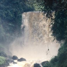
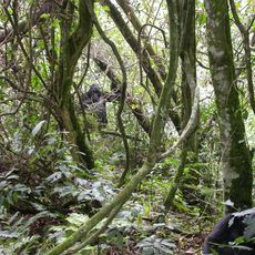
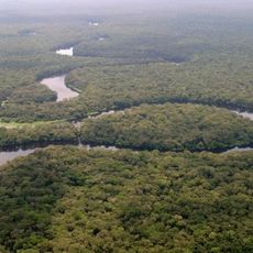
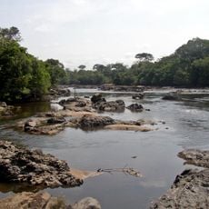
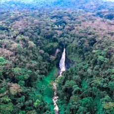
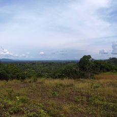
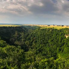
Bas-Uele is a province in northeastern Democratic Republic of the Congo characterized by dense forests and numerous river systems. The Uele River flows through its territory and shapes both the landscape and how people move through the region.

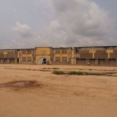
This province was created in 2015 when the former Orientale Province was divided into smaller administrative units. The establishment of this separate province brought new governance to the northeastern territories and designated Buta as its administrative center.

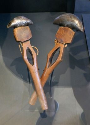
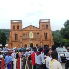
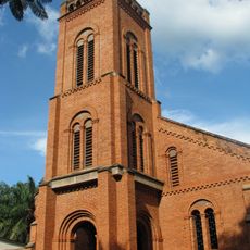
The Azande people make up most of the population here, and their traditions shape daily life and local customs throughout the region. You can see this cultural diversity reflected in the villages and how communities organize their daily activities.

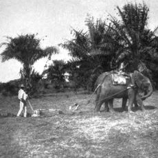
Getting around here takes extra time and planning since roads are mostly unpaved and transportation options are limited. Most travel happens on rough roads or by small aircraft, so visitors should expect slower movement through the territory.

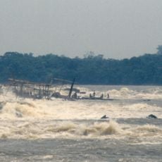
The capital city of Buta sits where the Rubi River meets other waterways, creating a natural hub for river trade and fishing. This location has made it an important gathering point for communities along the water routes.

The community of curious travelers

AroundUs brings together thousands of curated places, local tips, and hidden gems, enriched daily by 60,000 contributors worldwide.

Start exploring
Capital city
Buta
GPS coordinates
2.80556,24.74056
Latest update
December 8, 2025 13:42
Around this place
Virunga National Park
Congo, Democratic Republic of the

Virunga National Park

644.9 km
Bwindi Impenetrable National Park
Uganda

Bwindi Impenetrable National Park

700.6 km
Boyoma Falls
Congo, Democratic Republic of the

Boyoma Falls

262.6 km
Nyamuragira
Congo, Democratic Republic of the

Nyamuragira

683.4 km
Salonga National Park
Congo, Democratic Republic of the

Salonga National Park

600.9 km
Garamba National Park
Congo, Democratic Republic of the

Garamba National Park

518.4 km
Rwenzori Mountains National Park
Uganda

Rwenzori Mountains National Park

640.1 km
Okapi Wildlife Reserve
Congo, Democratic Republic of the

Okapi Wildlife Reserve

427.6 km
Kahuzi-Biéga National Park
Congo, Democratic Republic of the

Kahuzi-Biéga National Park

653 km
Maiko National Park
Congo, Democratic Republic of the

Maiko National Park

475.6 km
Margherita Peak
Congo, Democratic Republic of the

Margherita Peak

631.3 km
Cathédrale Notre-Dame
Central African Republic

Cathédrale Notre-Dame

706.4 km
Manovo-Gounda St. Floris National Park
Central African Republic

Manovo-Gounda St. Floris National Park

728.4 km
South Sudan

Southern National Park

572.9 km
Kyambura Game Reserve
Uganda

Kyambura Game Reserve

678.9 km
South Sudan

Shambe National Park

797 km
Uganda

Katwe craters

659.8 km
Api Elephant Domestication Center
Congo, Democratic Republic of the

Api Elephant Domestication Center

123.9 km
South Sudan

Juba Nile Bridge

795.2 km
Toro-Semliki Wildlife Reserve
Uganda

Toro-Semliki Wildlife Reserve

653.9 km
Uganda

Kalinzu Central Forest Reserve

690 km
South Sudan

St. Theresa Cathedral, Juba

794.4 km
Stade Lumumba
Congo, Democratic Republic of the

Stade Lumumba

259.1 km
St. Peter Claver Cathedral, Bangassou
Central African Republic

St. Peter Claver Cathedral, Bangassou

304.4 km
Mount Luigi di Savoia
Uganda

Mount Luigi di Savoia

635 km
Our Lady of the Rosary Cathedral, Kisangani
Congo, Democratic Republic of the

Our Lady of the Rosary Cathedral, Kisangani

260.3 km
Kagombe Central Forest Reserve
Uganda

Kagombe Central Forest Reserve

694.7 km
Ruwenzori
Congo, Democratic Republic of the

Ruwenzori

624.2 km
Show the full map
« Bas-Uele - Administrative province in northeastern Democratic Republic of the Congo » is provided by Around Us (aroundus.com). Images and texts are derived from Wikimedia project under a Creative Commons license. You are allowed to copy, distribute, and modify copies of this page, under the conditions set by the license, as long as this note is clearly visible.

Discover hidden gems everywhere you go!

From secret cafés to breathtaking viewpoints, skip the crowded tourist spots and find places that match your style. Our app makes it easy with voice search, smart filtering, route optimization, and insider tips from travelers worldwide. Download now for the complete mobile experience.

Around Us App Screenshot

A unique approach to discovering new places

Le Figaro

All the places worth exploring

France Info

A tailor-made excursion in just a few clicks

20 Minutes

Around Us
Travel Guide & Maps
Download

Send to your phone

QR Code
1

Open the camera app on your mobile.

2

Point at the QR code with your camera. A notification will appear.

3

Tap the notification to open the link.