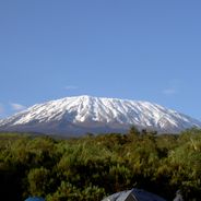
Serengeti National Park, Nature reserve in northern Tanzania
The 14,763-square-kilometer national park spans across eastern Mara Region and northeastern Simiyu Region, featuring vast savanna plains, woodland areas, and rivers.
The area gained protected status in 1930 as a game reserve covering 2,286 square kilometers before expanding into a national park in 1940.
The name Serengeti derives from the Maasai word 'siringet', referring to the endless expanse of grasslands that characterize the region.
The park maintains three principal sections: Seronera Valley in the central area, the Grumeti River corridor in the west, and the northern Lobo region.
The park hosts the annual migration of 1.5 million wildebeest and 250,000 zebras, traveling 800 kilometers between Tanzania and Kenya.
Location: Mara Region
Location: Simiyu Region
Inception: 2020
Operator: Tanzania National Parks Authority
Website: https://serengeti.com
GPS coordinates: -2.33278,34.56667
Latest update: May 27, 2025 20:48
Tanzania provides photographers with an extraordinary range of subjects, from the Serengeti plains to Zanzibar's coastline and Mount Kilimanjaro, the highest peak in Africa at 19,341 feet (5,895 meters). The country contains major wildlife reserves including Tarangire, where elephant herds move between baobab trees, and the Ngorongoro Crater, which holds a dense concentration of large mammals within its 100-square-mile (260-square-kilometer) caldera. Coastal regions and offshore islands like Mafia and Pemba offer opportunities to photograph coral reefs, sea turtles, and traditional dhow boats. The Mahale Mountains support habituated chimpanzee groups, while Selous Game Reserve presents riverine landscapes and diverse animal populations. Stone Town's historic quarter features Arab, Persian, and Indian architecture spanning several centuries, including the House of Wonders and the narrow alleys of the former trading port. The less visited Katavi National Park delivers scenes of hundreds of hippos crowding shrinking pools during the dry season. Kondoa rock art sites preserve prehistoric paintings dating back as far as 30,000 years. The active volcano Ol Doinyo Lengai and alkaline Lake Natron with its flamingo flocks add geological interest. From the terraced hillsides of the Usambara Mountains to the wildflower meadows of Kitulo National Park, Tanzania covers nearly every photographic interest.
Ngorongoro Conservation Area
139.3 km
Laetoli
114.4 km
Ol Doinyo Lengai
157.2 km
Tarangire National Park
243 km
Lake Manyara National Park
191.6 km
Ngorongoro Crater
146 km
Olorgesailie
225.7 km
Mau Forest
231.8 km
Thimlich Ohinga
162.7 km
Engaruka
170 km
Mount Suswa
236.5 km
Ruma National Park
193.1 km
Olduvai Gorge Museum
114.4 km
CCM Kirumba Stadium
186.3 km
Mount Hanang
251.6 km
Mount Homa
217 km
Mwalimu Nyerere Museum Centre
92.6 km
Abasuba Community Peace Museum
216.8 km
Ol Doinyo Orok
243.6 km
Kirumi Bridge
111.1 km
Lake Manyara Biosphere Reserve
205.6 km
Olare Orok Conservancy
123.4 km
Olmoti Crater
139 km
Kitumbeine Volcano
192.7 km
Caldeira de Rangwe
202.4 km
Ol Kinyei Conservancy
142.5 km
Serengeti Hippo Pool
0 m
Litein Tea Factory
207.3 kmReviews
Visited this place? Tap the stars to rate it and share your experience / photos with the community! Try now! You can cancel it anytime.
Discover hidden gems everywhere you go!
From secret cafés to breathtaking viewpoints, skip the crowded tourist spots and find places that match your style. Our app makes it easy with voice search, smart filtering, route optimization, and insider tips from travelers worldwide. Download now for the complete mobile experience.
A unique approach to discovering new places❞
— Le Figaro
All the places worth exploring❞
— France Info
A tailor-made excursion in just a few clicks❞
— 20 Minutes