Stirling Range National Park, national park in Australia
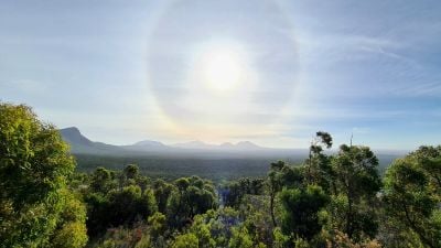
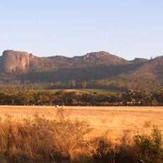
Stirling Range National Park is a protected area in the south of Western Australia, made up of a chain of peaks that rise sharply from a flat surrounding plain. The park is known for its plant diversity, with a high number of orchid and protea species that grow nowhere else in the world.
European explorers reached the area in the early 19th century and named the range after Sir James Stirling, the first governor of Western Australia. Its plant life drew scientific attention over the following decades, which eventually led to it being set aside as a protected park.
The Stirling Range holds deep meaning for the Noongar people, who have their own names and stories for many of the peaks and features here. Some guided walks offer a chance to hear about this connection directly from local knowledge holders.
The park sits roughly 3 hours (about 460 kilometers) southeast of Perth, with the Chester Pass Road running through it and giving access to the main trailheads. Weather in the peaks changes quickly, so bringing warm layers and enough water is a good idea even on clear days.
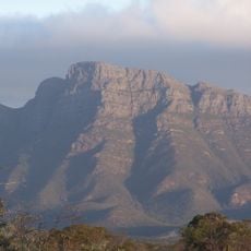
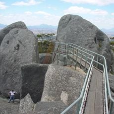
Bluff Knoll, the highest peak in the park, is one of the very few spots in Western Australia where snow occasionally falls in winter. On the way to the summit, walkers pass through noticeably different bands of vegetation, from low scrub to open rocky ridges, all within a relatively short climb.
The community of curious travelers
AroundUs brings together thousands of curated places, local tips, and hidden gems, enriched daily by 60,000 contributors worldwide.