Chest opened
+${chestReward.xp} XP
Explorer
NOUVEAU ×${chestReward.collectible.quantity}
tapez pour fermer
Chest locked

Open chests in the app

Around Us is built for your phone — chests unlock when you walk, explore and capture nearby places.

Enable Location

We need your location to show you interesting places around you

Discover nearby places

Find interesting locations and hidden gems around you

Precise directions

Get accurate directions and distances to places

Your location is never shared with other users. It's only used when you tap the location button.

Log in to your account

Start exploring — it's free

Trusted by 72,973 travelers worldwide

Continue with Google
Continue with Apple
or

We will send you a code to connect

By continuing, you accept our Terms and Conditions and our Privacy Policy

Check your inbox

We've sent a pincode in your inbox. Please enter the code below.

Camballin Irrigation Scheme
Discussion Reviews Photo
1.5k Popularity

Camballin Irrigation Scheme, Agricultural irrigation system in Western Australia

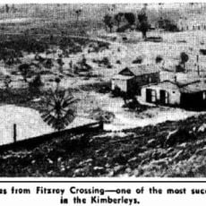
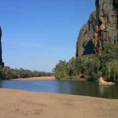
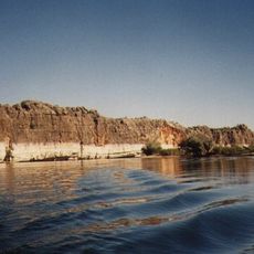
The Camballin Irrigation Scheme is an agricultural water system in Western Australia that includes a river barrage, the Seventeen Mile Dam, pump stations, and channels spreading across the landscape. The infrastructure featured grain storage silos at Broome Jetty and water management facilities, with a levee bank about 17 kilometers long built to protect against floods.

The system was established in the 1950s by Western Australia's Public Works Department as a major infrastructure project. It operated for several decades before being shut down in 1983 due to severe flooding problems that made continued operation difficult.

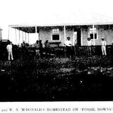
The scheme brought rice farming to the region and allowed farmers to experiment with different crops like sorghum, oats, and cotton. These new cultivation methods shifted how people approached agriculture in the area.

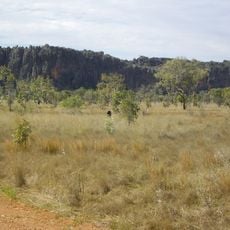
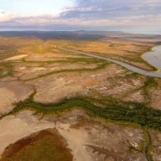
The site is located in the Kimberley region and is best visited during the dry season when roads are more reliable for travel. Most of the remaining structures are spread across remote areas, so exploration requires careful planning and preparation.

The scheme connected the Fitzroy River Barrage to an extensive network of irrigation channels across the Kimberley region. This integrated water management approach was innovative for its time, attempting to harness the river's natural flow patterns for farming.

The community of curious travelers

AroundUs brings together thousands of curated places, local tips, and hidden gems, enriched daily by 60,000 contributors worldwide.

Start exploring
GPS coordinates
-17.99100,124.19400
Latest update
December 14, 2025 14:40
Reviews
Share your experience

No review yet

Discussions
Start a discussion...

No discussion yet

« Camballin Irrigation Scheme - Agricultural irrigation system in Western Australia » is provided by Around Us (aroundus.com). Images and texts are derived from Wikimedia project under a Creative Commons license. You are allowed to copy, distribute, and modify copies of this page, under the conditions set by the license, as long as this note is clearly visible.

Discover hidden gems everywhere you go!

From secret cafés to breathtaking viewpoints, skip the crowded tourist spots and find places that match your style. Our app makes it easy with voice search, smart filtering, route optimization, and insider tips from travelers worldwide. Download now for the complete mobile experience.

Around Us App Screenshot

A unique approach to discovering new places

Le Figaro

All the places worth exploring

France Info

A tailor-made excursion in just a few clicks

20 Minutes

Around Us
Travel Guide & Maps
Download

Send to your phone

QR Code
1

Open the camera app on your mobile.

2

Point at the QR code with your camera. A notification will appear.

3

Tap the notification to open the link.