Lahat, Administrative division in South Sumatra, Indonesia.
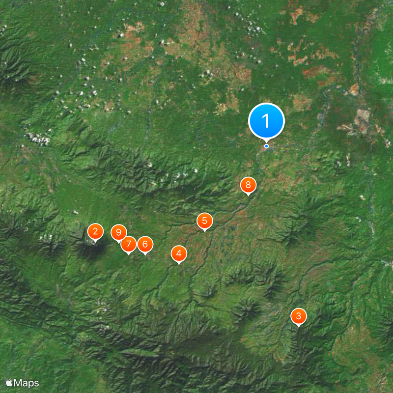
Lahat is an administrative regency spanning mountainous terrain in South Sumatra, bordered by neighboring regions and Bengkulu province. The area is divided into 24 sub-districts and numerous villages serving a population of around 400,000 people.
The region became officially established as an administrative unit in 1869, transforming from traditional tribal territories into a structured administrative region under Indonesian governance. This transition marked a shift from decentralized local authority to centralized administration.
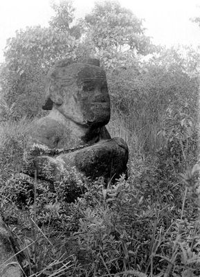
Multiple ethnic groups including the Lematang, Kikim, and Pasemah live throughout the territory, each maintaining their own ways of life and traditions visible in daily activities. These different communities have shaped the character of settlements across the region.
The territory is divided into multiple administrative sections spread across mountainous terrain, which affects travel time and route planning between villages. Seeking local guidance or asking residents for directions is helpful when exploring the different settlements and areas.
Archaeological digs near the Musi River found dozens of ancient burial urns in Kunduran village, revealing early burial practices of people who lived in this area. These discoveries show the region had human settlement reaching back many centuries.
The community of curious travelers
AroundUs brings together thousands of curated places, local tips, and hidden gems, enriched daily by 60,000 contributors worldwide.