Chest opened
+${chestReward.xp} XP
Explorer
NOUVEAU ×${chestReward.collectible.quantity}
tapez pour fermer

See the monuments around you in AR Open chests in the app

Around Us is built for your phone — point your camera at the streets and discover the monuments and places around you in augmented reality. Around Us is built for your phone — chests unlock when you walk, explore and capture nearby places.

•

Enable Location

We need your location to show you interesting places around you

Discover nearby places

Find interesting locations and hidden gems around you

Precise directions

Get accurate directions and distances to places

Your location is never shared with other users. It's only used when you tap the location button.

Westerfolds Park

Log in to your account

Start exploring — it's free

Trusted by 94,562 travelers worldwide

Continue with Google
Continue with Apple
or

We will send you a code to connect

By continuing, you accept our Terms and Conditions and our Privacy Policy

Check your inbox

We've sent a pincode in your inbox. Please enter the code below.

Westerfolds Park

Westerfolds Park, Park in Victoria, Australia

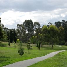
Westerfolds Park is a park on the banks of the Yarra River in the eastern suburbs of Melbourne, Victoria, with open grasslands, woodlands, and tall River Red Gums. The land rolls gently through hills and flat riverbanks, with viewing platforms positioned above the water and small rapids.

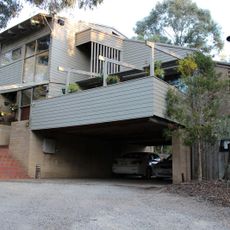
The land was home to the Wurundjeri People long before European settlers arrived in the mid-1800s. A private family bought the property in the 1930s and built the Manor House on the hill, and the area became an official park in 1977.

The park is accessible from Fitzsimons Lane or Porter Street in Templestowe, with parking available at both entrances. Dogs must be kept on a leash throughout, and it is worth checking current conditions before visiting as some areas may be temporarily closed.

The Manor House, built by the Turner family in 1936, later housed the Mia Mia Gallery and Cafe, which showed Indigenous Australian art and ran cultural education programs until it closed in 2013. The surrounding dairy farms and orchards were subdivided for housing after World War II, but flood-prone Westerfolds was left out and joined the Yarra Valley Parklands in 1977.

The community of curious travelers

AroundUs brings together thousands of curated places, local tips, and hidden gems, enriched daily by 94,562 contributors worldwide.

Start exploring
Location
GPS coordinates
-37.74700,145.12900
Latest update
October 31, 2026 05:56
Reviews
Share your experience

No review yet

Discussions
Start a discussion...

No discussion yet

« Westerfolds Park - Park in Victoria, Australia » is provided by Around Us (aroundus.com). Images and texts are derived from Wikimedia project under a Creative Commons license. You are allowed to copy, distribute, and modify copies of this page, under the conditions set by the license, as long as this note is clearly visible.

Discover hidden gems everywhere you go!

From secret cafés to breathtaking viewpoints, skip the crowded tourist spots and find places that match your style. Our app makes it easy with voice search, smart filtering, route optimization, and insider tips from travelers worldwide. Download now for the complete mobile experience.

Around Us App Screenshot
❝

A unique approach to discovering new places❞

— Le Figaro

❝

All the places worth exploring❞

— France Info

❝

A tailor-made excursion in just a few clicks❞

— 20 Minutes

Around Us
Travel Guide & Maps
Download

Send to your phone

QR Code
1

Open the camera app on your mobile.

2

Point at the QR code with your camera. A notification will appear.

3

Tap the notification to open the link.