Chest opened
+${chestReward.xp} XP
Explorer
NOUVEAU ×${chestReward.collectible.quantity}
tapez pour fermer
Chest locked

Open chests in the app

Around Us is built for your phone — chests unlock when you walk, explore and capture nearby places.

Enable Location

We need your location to show you interesting places around you

Discover nearby places

Find interesting locations and hidden gems around you

Precise directions

Get accurate directions and distances to places

Your location is never shared with other users. It's only used when you tap the location button.

Moruya

Log in to your account

Start exploring — it's free

Trusted by 72,887 travelers worldwide

Continue with Google
Continue with Apple
or

We will send you a code to connect

By continuing, you accept our Terms and Conditions and our Privacy Policy

Check your inbox

We've sent a pincode in your inbox. Please enter the code below.

Discussion Reviews 4 Photos
21.1k Popularity

Moruya, Administrative division in New South Wales, Australia

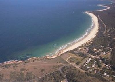
Moruya is a town situated along the Moruya River, roughly 305 kilometers south of Sydney. It functions as the administrative center for the Eurobodalla Shire, serving as the focal point for government services in the surrounding coastal region.

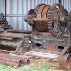
A granite quarry established in 1876 supplied stone for the construction of the Sydney Harbour Bridge, linking this location to a major Australian infrastructure project. This early industrial operation shaped the town's economic role during the late 19th and early 20th centuries.

The name comes from the Tharawal Aboriginal language and refers to land where black swans once gathered in large numbers. You can sense this cultural connection in local storytelling and the way the community honors its Indigenous roots.

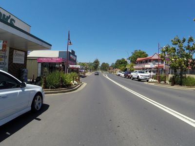
The town is easily accessible for day trips or longer stays and provides good access to regional services and facilities. Visitors can stop here to gather information about the surrounding coastal area or handle administrative needs while exploring the region.

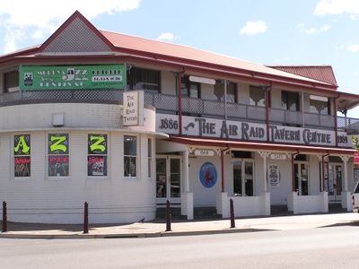
The local aerodrome was repurposed as a military base during World War II, directly connecting this coastal town to national defense efforts during wartime. Few visitors realize how this wartime transformation left its mark on the area's infrastructure and local memory.

The community of curious travelers

AroundUs brings together thousands of curated places, local tips, and hidden gems, enriched daily by 60,000 contributors worldwide.

Start exploring
Location
Location
Elevation above the sea
4 m
Shares border with
Kiora, Mogendoura, Wamban, Bergalia, Bimbimbie, Broulee, Moruya Heads, Congo, Mogo
GPS coordinates
-35.91111,150.08056
Latest update
March 4, 2026 16:16
Reviews
Share your experience

No review yet

Discussions
Start a discussion...

No discussion yet

« Moruya - Administrative division in New South Wales, Australia » is provided by Around Us (aroundus.com). Images and texts are derived from Wikimedia project under a Creative Commons license. You are allowed to copy, distribute, and modify copies of this page, under the conditions set by the license, as long as this note is clearly visible.

Discover hidden gems everywhere you go!

From secret cafés to breathtaking viewpoints, skip the crowded tourist spots and find places that match your style. Our app makes it easy with voice search, smart filtering, route optimization, and insider tips from travelers worldwide. Download now for the complete mobile experience.

Around Us App Screenshot

A unique approach to discovering new places

Le Figaro

All the places worth exploring

France Info

A tailor-made excursion in just a few clicks

20 Minutes

Around Us
Travel Guide & Maps
Download

Send to your phone

QR Code
1

Open the camera app on your mobile.

2

Point at the QR code with your camera. A notification will appear.

3

Tap the notification to open the link.