Mount Cargill, Volcanic summit in northern Dunedin, New Zealand.
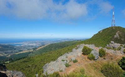
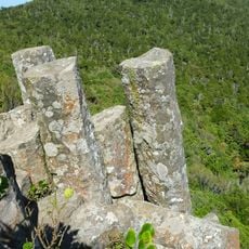
Mount Cargill is a volcanic summit in northern Dunedin, New Zealand, rising to 676 meters above sea level and covered in native forest. Its ridges and rock outcrops show the clear marks of ancient volcanic forces that shaped the whole landform.
The mountain was named after Captain William Cargill, who led the early European settlement of the Otago Province in the 1840s. Before that, the summit had long been known to local Māori, who used the surrounding land for generations.
In Māori tradition, the mountain's outline is read as the figure of a warrior, giving it a lasting place in the oral stories of the region. Visitors who reach the top often learn this connection through interpretation panels placed along the track.
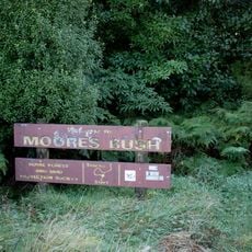
The main track starts at Bethune's Gully and passes through forest sections with stepped paths and sometimes muddy ground, so sturdy footwear is a good idea. Weather can change quickly on the slopes, so bringing a waterproof layer is wise even on a clear morning.
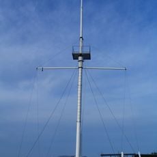
A broadcasting tower built in the 1970s at the summit sends television and radio signals across eastern Otago, making the peak a working part of the region's media network. Many walkers notice it only when they arrive at the top, even though it is visible from much of Dunedin below.
The community of curious travelers
AroundUs brings together thousands of curated places, local tips, and hidden gems, enriched daily by 60,000 contributors worldwide.