Roys Peak, Mountain summit near Wanaka, New Zealand
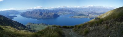
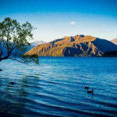
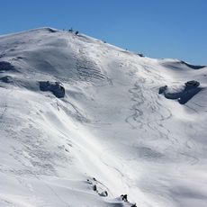
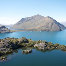
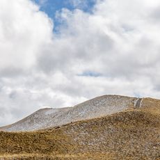
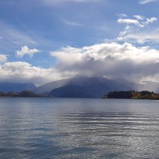
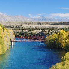
Roys Peak is a mountain summit near Wanaka reached by a steep hiking trail that climbs through farmland and open hillside. The route follows a ridge with few sheltered areas and reaches a bare summit where views stretch across Lake Wānaka and toward the Southern Alps.
Early settlers named the mountain after the Scottish outlaw Rob Roy MacGregor during European exploration of the region. Māori people had traveled through this landscape long before, using routes between the lakes for trade and movement.
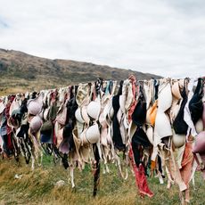
The mountain sits within working farmland where shepherds manage sheep herds seasonally, and local communities maintain the trail as part of their daily landscape. The track reflects how people here balance outdoor recreation with agricultural traditions.
The trail is fully exposed with no shade from start to finish, so sun protection and wind-resistant clothing are essential. Afternoon weather can change quickly, making an early start and careful timing crucial for a safe return before dark.
The most photographed viewpoint sits on a rocky platform about 30 minutes below the true summit, framing Lake Wānaka and the mountain range perfectly. Many hikers stop there and never reach the actual top, making it an unofficial endpoint for those chasing views rather than altitude.
Location: Queenstown-Lakes District
Elevation above the sea: 1,578 m
GPS coordinates: -44.69400,169.04873
Latest update: December 6, 2025 16:02
New Zealand provides photographic subjects ranging from the Southern Alps to sand beaches on both coastlines. The landscape includes thermal springs in Rotorua, glaciers like Franz Josef and Tasman, and fjords in Fiordland. Mount Cook dominates the alpine region while the Coromandel Peninsula holds...
That Wānaka Tree
5.4 km
Cardrona Bra Fence
19 km
Mount Cardrona
19.5 km
Warbirds and Wheels
15.8 km
National Transport and Toy Museum
15.5 km
Arrow Kilwinning Lodge
32.2 km
Leaning Tower of Wanaka
9 km
Mou Waho Island Scenic Reserve
15.9 km
Cobbled Gutters
32.3 km
Arrowtown Powder Magazine
32.7 km
St Columba's Anglican Church
6.5 km
Arrowtown Library
32.1 km
Isthmus Peak
28.4 km
Roys Bay
5.7 km
The Old Convent
32.3 km
Arrowtown and Districts War Memorial
32.4 km
St Paul's Anglican Church and Vestry
32.4 km
Stables
32.2 km
Arrowtown Gaol
32.2 km
Esplanade Reserve
20 km
Bank of New Zealand Agency Building
32.2 km
Arrowtown Borough Council Building
32.1 km
Reid's Stables
32.3 km
Cardrona Hotel False Front
21.2 kmFoxs Gully
30.9 km
The Red Bridge
18.9 km
Skippers Road
33.2 kmVisited this place? Tap the stars to rate it and share your experience / photos with the community! Try now! You can cancel it anytime.
Discover hidden gems everywhere you go!
From secret cafés to breathtaking viewpoints, skip the crowded tourist spots and find places that match your style. Our app makes it easy with voice search, smart filtering, route optimization, and insider tips from travelers worldwide. Download now for the complete mobile experience.
A unique approach to discovering new places❞
— Le Figaro
All the places worth exploring❞
— France Info
A tailor-made excursion in just a few clicks❞
— 20 Minutes