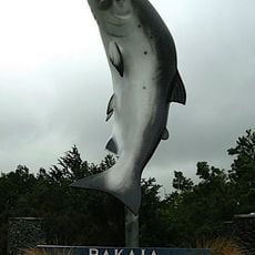
Rakaia Bridge, Road bridge in Canterbury Region, New Zealand
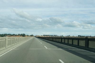
Rakaia Bridge is a road bridge that carries State Highway 1 across the Rakaia River in the Canterbury Region. The structure consists of 144 concrete spans stretching approximately 1,756 meters (5,761 feet) and carries around 13,000 vehicles per day.
The current bridge was constructed between March 1937 and March 1939, replacing an earlier combined road and rail structure from 1873. The newer design was needed to accommodate growing traffic demand and to separate automobile traffic from rail transport.
The bridge serves as a daily connection for thousands of travelers crossing the Rakaia River, linking communities on both sides of the Canterbury Region. It represents the region's reliance on this route for commerce and movement between populated areas.
The bridge has two lanes and carries regular through traffic, so it is best crossed during off-peak times to avoid congestion. Clear signage on State Highway 1 makes navigation straightforward, and nearby viewpoints offer opportunities to observe the river landscape.
The bridge holds the distinction of being the longest road bridge in the Southern Hemisphere, making it a remarkable span across the river landscape. This extraordinary length becomes apparent when approaching from a distance, creating an impressive visual presence on the highway.
The community of curious travelers
AroundUs brings together thousands of curated places, local tips, and hidden gems, enriched daily by 60,000 contributors worldwide.