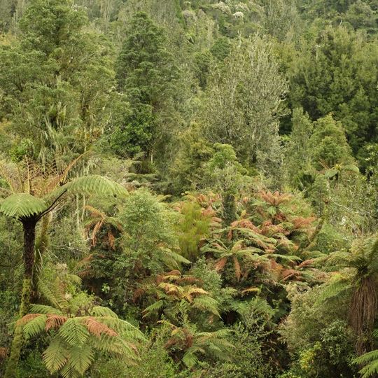
Pirongia Forest Park, Protected forest area in Waikato region, New Zealand
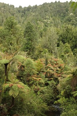
Pirongia Forest Park is a 167.7 km² protected area 30 km southwest of Hamilton, made up of four blocks: Pirongia (the largest), Te Maunga O Karioi, Mangakino and Te Rauamoa. It covers Mount Pirongia (959 m) and Mount Karioi (756 m) and is mostly podocarp forest of rimu, totara, kahikatea and tawa with tree ferns.
Ngāti Apakura, Ngāti Hikairo and Ngāti Māhanga occupied most of the area before colonisation, and a small north-eastern part fell within the 1865 confiscation line, which now largely marks the remaining bush edge. The summit was bought in 1900, a 2,183-acre scenic reservation followed in 1937, and the park was declared in 1971. Mount Karioi was added in 1976 and Tapuwaeohounuku in 1984; the Department of Conservation took over management in 1987.
Before colonisation, Ngāti Apakura, Ngāti Hikairo and Ngāti Māhanga occupied most of what is now the forest park. A small area to the north-east fell within the 1865 confiscation line, and that boundary still largely marks where bush remains. The rest stayed in Māori ownership until the summit was bought in 1900.
Access is via State Highway 39 past the town of Pirongia, or via State Highways 23 and 31 to the north and south. The park has three free campsites, a lodge and one hut near the Mount Pirongia summit. Hunting and fishing in the Kaniwhaniwha Stream need permits; the Nikau Track suits cycling.
The Bell Track leads to a kahikatea measured at 66.5 m, the tallest recorded native tree in New Zealand. The same track continues to the 959 m summit of Mount Pirongia, where The Cone rises 953 m about 1 km to the west.
The community of curious travelers
AroundUs brings together thousands of curated places, local tips, and hidden gems, enriched daily by 93,632 contributors worldwide.