Mangere Bridge, Concrete road bridge in Auckland Region, New Zealand.
Mangere Bridge is a concrete road bridge that crosses the Manukau Harbour, connecting the suburb of Māngere Bridge to the south with Onehunga to the north. The crossing carries road traffic alongside dedicated paths for pedestrians and cyclists, running directly over the open harbour water.
A basalt causeway used by Tāmaki Māori crossed here at low tide until 1858, when dynamite destroyed much of it for shipping. A narrow timber truss bridge designed by Arthur Guyon Purchas opened in January 1875 on Australian jarrah piles, but shipworms and single-lane width doomed it; it closed in 1914. Its replacement, a 246-metre ferro-concrete bridge by R.F. Moore, opened on 31 May 1915, and the 1983 motorway bridge was joined by a duplicate in 2010.
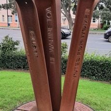
The bridge carries the Māori name Ngā Hau Māngere, meaning "the winds of Māngere". Along the crossing, art installations and popular fishing spots mark how local residents use the space as part of their everyday life.
The 1983 span's suspended cycle and pedestrian path closed in 2022; walkers and cyclists now use Ngā Hau Māngere, the replacement bridge opened that year. Drivers cross on the 1983 motorway span or its 2010 eastern duplicate, which together give ten lanes across the harbour. The old concrete bridge, closed to motor vehicles in 1983, still stands beside them.
The 1915 ferro-concrete bridge, designed by R.F. Moore and built by the Ferro-Concrete Company of Australasia, used prefabricated concrete, an unusual method in New Zealand then. During World War II an anti-tank road block stood near the middle of its spans, with a small sentry shelter close by; both were later removed.
The community of curious travelers
AroundUs brings together thousands of curated places, local tips, and hidden gems, enriched daily by 94,039 contributors worldwide.