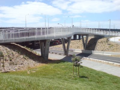
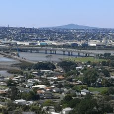
Onehunga Harbour Road Bridge, bridge in Onehunga, Auckland
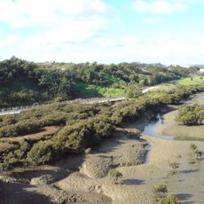
The Onehunga Harbour Road Bridge is a footbridge and bicycle bridge in the Auckland Region. It spans across the harbour to connect both sides and serves pedestrians and cyclists traveling across the water.
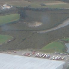
The bridge was constructed to improve connections between Onehunga and other parts of Auckland. It has become an important route for local movement and daily commuting.
The bridge is straightforward to cross on foot or by bicycle. The paths are open and provide good views across the harbour and surrounding areas.
Location: Auckland Region
Official opening: 2010
GPS coordinates: -36.93150,174.78600
Latest update: December 6, 2025 17:47
Auckland sits between the Pacific Ocean and the Tasman Sea on a narrow isthmus marked by roughly 50 extinct volcanic cones. Mount Eden and One Tree Hill rise above the neighborhoods and offer views across the harbor, while Rangitoto stands as the largest volcanic island in the region and can be reached by ferry. The coastline shifts between the sheltered eastern beaches such as Mission Bay and Takapuna Beach and the black sand western shores at Piha and Bethells Beach, where the Pacific meets the Waitakere Ranges directly. The Auckland War Memorial Museum in Auckland Domain holds Polynesian collections and New Zealand military history, while Auckland Art Gallery displays European and indigenous art. Viaduct Harbour serves as a dining precinct and departure point for harbor cruises, and the New Zealand Maritime Museum documents the country's seafaring past. Karangahape Road gathers alternative shops and nightlife, Ponsonby draws an older crowd with cafés and boutiques. Britomart clusters restaurants and design stores in converted waterfront buildings. Waiheke Island hosts wineries such as Mudbrick Vineyard and Man O' War Vineyards scattered among vineyards and bays, while Tantalus Estate operates in West Auckland. Auckland Botanic Gardens present native plant species across 158 acres, and Auckland Zoo keeps over 1,400 animals. Queen Street runs through the center from the harbor to the University of Auckland, and Sky Tower stands 1,076 feet (328 meters) above the city. This selection covers the main sites for understanding Auckland's geography and range.
Mount Smart Stadium
2.8 km
Maungakiekie / One Tree Hill
3.5 km
Pah Homestead
2.8 km
Māngere Mountain
1.9 km
Mangere Bridge
260 m
Stardome Observatory
3 km
Rarotonga / Mount Smart
3 km
Our Lady of the Assumption Catholic Church
1 km
Te Puea Memorial Marae
1.3 km
Cornwall Park Stadium
4.1 km
National Heart Foundation of New Zealand
4.1 km
Waikaraka Cycleway
1.2 km
Onehunga Primary School
1.3 km
Harania Creek
3.4 km
Puketapapa Women's Suffrage Memorial
3.5 km
Pleasant Villa
1.8 km
Onehunga Post Office
727 m
Carnegie Free Library
683 m
Onehunga Blockhouse
1.5 km
Ker House
4 km
Anns Creek
3.9 km
Cornwall Park Stone Wall
4.2 km
Tararata Creek
2.2 km
One Tree Hill Obelisk
3.5 km
Marire
3.9 km
Whittome House
4 km
Māngere Bridge Library
1.2 km
Penrose Business Plaza
3.2 kmReviews
Visited this place? Tap the stars to rate it and share your experience / photos with the community! Try now! You can cancel it anytime.
Discover hidden gems everywhere you go!
From secret cafés to breathtaking viewpoints, skip the crowded tourist spots and find places that match your style. Our app makes it easy with voice search, smart filtering, route optimization, and insider tips from travelers worldwide. Download now for the complete mobile experience.
A unique approach to discovering new places❞
— Le Figaro
All the places worth exploring❞
— France Info
A tailor-made excursion in just a few clicks❞
— 20 Minutes