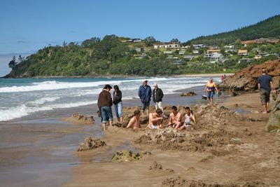
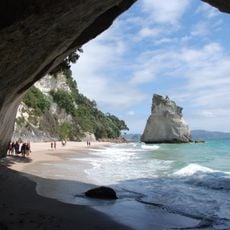
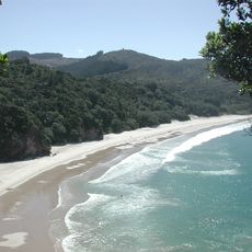
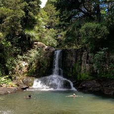
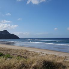
Hot Water Beach, Geothermal beach in Coromandel Peninsula, New Zealand
The 1.5-kilometer stretch of golden sand features natural underground springs that release water reaching temperatures of 64 degrees Celsius through the surface.
The thermal waters of Hot Water Beach have sustained the indigenous Ngāti Hei iwi communities since their early settlement in the Coromandel Peninsula region.
Local Māori tribes maintain their ancestral connection to this geothermal site through traditional practices and knowledge passed down through generations.
Visitors need to check local tide schedules and arrive two hours before or after low tide to access the thermal waters beneath the sand.
During low tide, people can create their personal thermal pools by digging into specific spots where hot springs emerge through the beach sand.
Location: Thames-Coromandel District
GPS coordinates: -36.87980,175.81888
Latest update: May 27, 2025 06:53
New Zealand provides photographic subjects ranging from the Southern Alps to sand beaches on both coastlines. The landscape includes thermal springs in Rotorua, glaciers like Franz Josef and Tasman, and fjords in Fiordland. Mount Cook dominates the alpine region while the Coromandel Peninsula holds beaches including Hot Water Beach and Cathedral Cove. The Tongariro Alpine Crossing traverses volcanic terrain and Mount Taranaki rises above Taranaki. Coastal formations like the Moeraki Boulders, Split Apple Rock and Nugget Point demonstrate geological variety. Natural waterfalls including Purakaunui Falls and Whangarei Falls sit among native forests. Cultural sites complement the natural geography. The Hobbiton Movie Set near Matamata displays the film location from the Tolkien adaptation. Larnach Castle near Dunedin represents colonial architecture. Te Puia and Wai-O-Tapu demonstrate geothermal activity with geysers and colored pools. Waitomo Caves contains glowworm caverns. Lake Tekapo offers clear night skies for stargazing. Viewpoints like Roy's Peak near Wanaka and Queenstown Hill sit above lake landscapes. Remote regions including Cape Reinga at the northern tip and Cape Palliser in the Wairarapa show different coastal environments. The Forgotten World Highway crosses historic mountain country on the North Island.
Te Whanganui-o-Hei / Cathedral Cove Marine Reserve
7.5 km
Driving Creek Railway
32.2 km
New Chums Beach
27.8 km
Coromandel Forest Park
23.2 km
Siamese Kauri
24.1 km
Waiau Falls
24.8 km
Aldermen Islands Nature Reserve
9.6 km
St John's Church
37.1 km
Saxon Shafts Pump Station
37.6 km
Assay House Tearooms
31.6 km
Rostgard’s Drapery
31.6 km
Sailors Grave Historic Reserve
9.4 km
World War One Memorial
37.4 km
Queen Victoria Monument
31.7 km
School of Mines Museum
31.5 km
Ward Cottage
32 km
Pauanui Beach
15.8 km
Methodist Church
31.5 km
House
31.5 km
Primary School and Shelter Sheds
31.6 km
Masonic Lodge No 17
31.5 km
Thames Borough Council Office
37.7 km
Shop Frontage
37.7 km
Hauraki Mine Office
31.5 km
Museum of Technology
37.5 km
Government Battery
31.7 km
Coromandel Courthouse
31.7 km
Thames North School
37.1 kmReviews
Visited this place? Tap the stars to rate it and share your experience / photos with the community! Try now! You can cancel it anytime.
Discover hidden gems everywhere you go!
From secret cafés to breathtaking viewpoints, skip the crowded tourist spots and find places that match your style. Our app makes it easy with voice search, smart filtering, route optimization, and insider tips from travelers worldwide. Download now for the complete mobile experience.
A unique approach to discovering new places❞
— Le Figaro
All the places worth exploring❞
— France Info
A tailor-made excursion in just a few clicks❞
— 20 Minutes