Enable Location

We need your location to show you interesting places around you

Discover nearby places

Find interesting locations and hidden gems around you

Precise directions

Get accurate directions and distances to places

Your location is never shared with other users. It's only used when you tap the location button.

Mount Hikurangi

Log in to your account

Start exploring — it's free

Trusted by 62,190 travelers worldwide

Continue with Google
Continue with Apple
or

We will send you a code to connect

By continuing, you accept our Terms and Conditions and our Privacy Policy

Check your inbox

We've sent a pincode in your inbox. Please enter the code below.

Mount Hikurangi

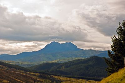
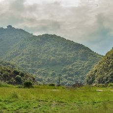
Mount Hikurangi, Mountain summit in Raukumara Range, New Zealand.

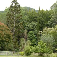
Mount Hikurangi is the highest non-volcanic peak on New Zealand's North Island, rising 1,752 meters above sea level. It sits in the Raukumara Range roughly 80 kilometers north of Gisborne and is surrounded by alpine vegetation.

The summit was classified as state forest land until 1990, when it was returned to Ngāti Porou. This transfer represented an important recognition of land rights for the local community.

The mountain holds deep spiritual meaning for Ngāti Porou people, rooted in stories of creation and emergence from the sea. Visitors experience this connection through how the land is cared for and the names and practices that shape the place today.

The trek to the summit takes about seven hours from the car park and requires advance permission and a booking at the small mountain hut that sleeps eight people. Access goes through Pakihiroa land, so visitors should plan and organize their visit well ahead of time.

The summit marks the northernmost location for alpine vegetation in New Zealand, including rare species like the Hikurangi tutu shrub. This botanical boundary makes the area especially noteworthy for plant enthusiasts and hikers.

The community of curious travelers

AroundUs brings together thousands of curated places, local tips, and hidden gems, enriched daily by 60,000 contributors worldwide.

Start exploring
GPS coordinates
-37.91893,178.06074
Latest update
December 10, 2025 15:50
« Mount Hikurangi - Mountain summit in Raukumara Range, New Zealand » is provided by Around Us (aroundus.com). Images and texts are derived from Wikimedia project under a Creative Commons license. You are allowed to copy, distribute, and modify copies of this page, under the conditions set by the license, as long as this note is clearly visible.

Discover hidden gems everywhere you go!

From secret cafés to breathtaking viewpoints, skip the crowded tourist spots and find places that match your style. Our app makes it easy with voice search, smart filtering, route optimization, and insider tips from travelers worldwide. Download now for the complete mobile experience.

Around Us App Screenshot

A unique approach to discovering new places

Le Figaro

All the places worth exploring

France Info

A tailor-made excursion in just a few clicks

20 Minutes

Around Us
Travel Guide & Maps
Download

Send to your phone

QR Code
1

Open the camera app on your mobile.

2

Point at the QR code with your camera. A notification will appear.

3

Tap the notification to open the link.