Chest opened
+${chestReward.xp} XP
Explorer
NOUVEAU ×${chestReward.collectible.quantity}
tapez pour fermer
Chest locked

Open chests in the app

Around Us is built for your phone — chests unlock when you walk, explore and capture nearby places.

Enable Location

We need your location to show you interesting places around you

Discover nearby places

Find interesting locations and hidden gems around you

Precise directions

Get accurate directions and distances to places

Your location is never shared with other users. It's only used when you tap the location button.

Gunnedah

Log in to your account

Start exploring — it's free

Trusted by 72,891 travelers worldwide

Continue with Google
Continue with Apple
or

We will send you a code to connect

By continuing, you accept our Terms and Conditions and our Privacy Policy

Check your inbox

We've sent a pincode in your inbox. Please enter the code below.

Discussion Reviews 2 Photos
25.6k Popularity

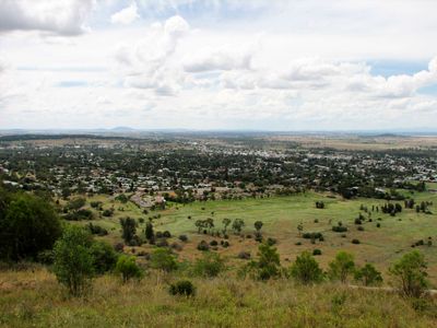
Gunnedah, Administrative division in New South Wales, Australia

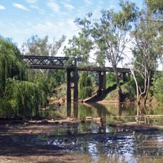
Gunnedah is an administrative region on the Liverpool Plains in northern New South Wales, stretching between the Nandewar and Great Dividing Ranges. The area includes smaller towns such as Curlewis, Breeza, Carroll, Mullaley, Emerald Hill, Tambar Springs, and Kelvin across a rural landscape.

The region was established on January 1, 1980, through the merger of the Municipality of Gunnedah and Liverpool Plains Shire to create a more unified administration. This combination brought together two separate local governance structures into one.

The region has deep roots with the Gamilaroi Nation, and you can see this connection in local events and artwork throughout the towns. Indigenous presence shapes how communities gather and celebrate together.

This is a rural area with low population density, so visitors should plan extra travel time between the scattered towns and villages. Having your own transport is essential, and it helps to check ahead what facilities are available in smaller settlements.

The area is home to a significant koala reserve where visitors can observe these animals in their natural habitat. This protected area makes the region an important spot for watching one of Australia's most iconic animals.

The community of curious travelers

AroundUs brings together thousands of curated places, local tips, and hidden gems, enriched daily by 60,000 contributors worldwide.

Start exploring
Location
Location
Location
Elevation above the sea
273 m
Shares border with
Emerald Hill, Blue Vale, Kelvin, Milroy, Marys Mount, Curlewis, Carroll, Orange Grove
GPS coordinates
-30.96667,150.25000
Latest update
March 4, 2026 16:16
Reviews
Share your experience

No review yet

Discussions
Start a discussion...

No discussion yet

« Gunnedah - Administrative division in New South Wales, Australia » is provided by Around Us (aroundus.com). Images and texts are derived from Wikimedia project under a Creative Commons license. You are allowed to copy, distribute, and modify copies of this page, under the conditions set by the license, as long as this note is clearly visible.

Discover hidden gems everywhere you go!

From secret cafés to breathtaking viewpoints, skip the crowded tourist spots and find places that match your style. Our app makes it easy with voice search, smart filtering, route optimization, and insider tips from travelers worldwide. Download now for the complete mobile experience.

Around Us App Screenshot

A unique approach to discovering new places

Le Figaro

All the places worth exploring

France Info

A tailor-made excursion in just a few clicks

20 Minutes

Around Us
Travel Guide & Maps
Download

Send to your phone

QR Code
1

Open the camera app on your mobile.

2

Point at the QR code with your camera. A notification will appear.

3

Tap the notification to open the link.