Tamworth

Log in to your account

AroundUs is a community-driven map of interesting places, built by curious explorers like you. It grows with every review, story, and photo you share.
Connect to save your favorite spots, contribute locations, and create personalized routes.
Continue with Google
Continue with Apple
Continue with X
Continue with Facebook
Continue with email
By continuing, you accept our Terms and Conditions and our Privacy Policy
Create an account
Add to collection
Map
Suggest a change
Share

Tamworth, Administrative center in New South Wales, Australia

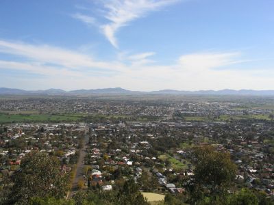
Tamworth sits along the Peel River and forms the main urban center in northeastern New South Wales with 43,874 residents. The city spreads across both riverbanks, with the business district concentrated on the north side and residential areas climbing gentle hills to the south and west.

The Kamilaroi lived in this region before European settlers founded sheep farms in 1831, leading to the official town establishment in 1850. The railway arrival in 1878 transformed the site into an important regional trading center for agricultural products.

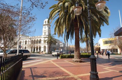
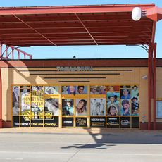
The city bears the name of Robert Peel, the second Viscount Tamworth, which appears in street names and historic buildings throughout the center. Visitors notice references to the country music tradition everywhere, from murals showing guitars to bronze statues of well-known musicians along the main street.

The regional airport offers regular domestic flights, while public buses and trains connect points within the region. Drivers find free parking in most areas of the center, with main roads clearly signposted.

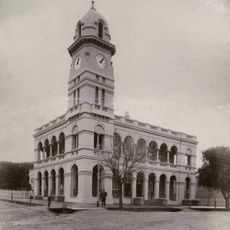
This city introduced electric street lighting in 1888 as the first location in Australia, earning the nickname First Town of Lights. A small museum in the power station documents this technical achievement with original lamps and historical photographs from that era.

Location: New South Wales

Location: Tamworth Regional Council

Location: Tamworth

Inception: 1850

Elevation above the sea: 404 m

Shares border with: North Tamworth, Taminda, Calala, East Tamworth, West Tamworth

Website: http://tamworth.nsw.gov.au/asp

GPS coordinates: -31.09056,150.93167

Latest update: December 13, 2025 15:54

Photos
Reviews

Visited this place? Tap the stars to rate it and share your experience / photos with the community! Try now! You can cancel it anytime.

« Tamworth - Administrative center in New South Wales, Australia » is provided by Around Us (aroundus.com). Images and texts are derived from Wikimedia project under a Creative Commons license. You are allowed to copy, distribute, and modify copies of this page, under the conditions set by the license, as long as this note is clearly visible.

Discover hidden gems everywhere you go!

From secret cafés to breathtaking viewpoints, skip the crowded tourist spots and find places that match your style. Our app makes it easy with voice search, smart filtering, route optimization, and insider tips from travelers worldwide. Download now for the complete mobile experience.

Around Us App Screenshot

A unique approach to discovering new places

Le Figaro

All the places worth exploring

France Info

A tailor-made excursion in just a few clicks

20 Minutes