Enable Location

We need your location to show you interesting places around you

Discover nearby places

Find interesting locations and hidden gems around you

Precise directions

Get accurate directions and distances to places

Your location is never shared with other users. It's only used when you tap the location button.

Matanuska River

Log in to your account

Start exploring — it's free

Trusted by 65,090 travelers worldwide

Continue with Google
Continue with Apple
or

We will send you a code to connect

By continuing, you accept our Terms and Conditions and our Privacy Policy

Check your inbox

We've sent a pincode in your inbox. Please enter the code below.

Matanuska River
Discussion Reviews 1 Photos
5.4k Popularity

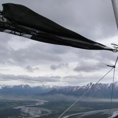
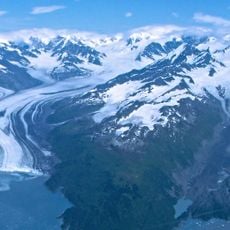
Matanuska River, Brook in Southcentral Alaska, United States

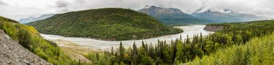
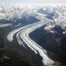
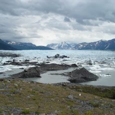
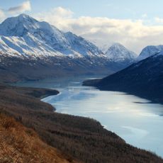
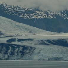
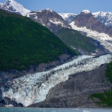
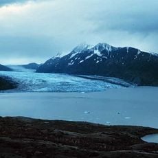
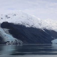
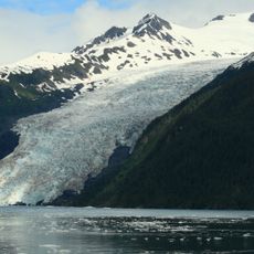
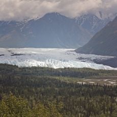
The Matanuska River is a river in southcentral Alaska that flows southwest through a broad valley before emptying into Knik Arm, which connects to Cook Inlet. The water comes largely from the Matanuska Glacier, which gives the river a milky, gray-blue color for much of the year.

The Dena'ina Athabascan people knew this river as Ch'atanhtnu, meaning 'trail comes out river', pointing to its role as a travel route long before European contact. Russian and American explorers later mapped the valley, which eventually opened the area to farming and settlement in the early 20th century.

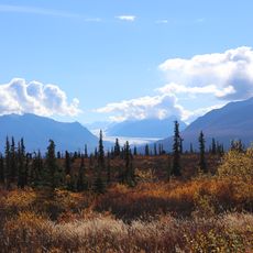
Salmon fishing is a common activity along this river, and certain spots on its banks have been visited by local families for generations. The poplars and spruces lining the shore give the valley a green, wooded feel that is easy to notice from the road.

Several spots along the river can be reached by car, including Chickaloon Bridge and King Mountain Wayside, both of which offer direct access to the water. A summer visit tends to work best, as water levels are higher and conditions for fishing or paddling are more reliable.

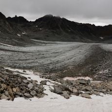
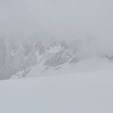
The river carries so much sediment from the glacier that its bed constantly shifts, splitting into several channels that move from year to year in what geologists call a braided river system. This movement makes the riverbed look different each season and can change which banks are safe to walk on.

The community of curious travelers

AroundUs brings together thousands of curated places, local tips, and hidden gems, enriched daily by 60,000 contributors worldwide.

Start exploring
GPS coordinates
61.78291,-148.13835
Latest update
March 3, 2026 08:17
Reviews
Share your experience

No review yet

Discussions
Start a discussion...

No discussion yet

« Matanuska River - Brook in Southcentral Alaska, United States » is provided by Around Us (aroundus.com). Images and texts are derived from Wikimedia project under a Creative Commons license. You are allowed to copy, distribute, and modify copies of this page, under the conditions set by the license, as long as this note is clearly visible.

Discover hidden gems everywhere you go!

From secret cafés to breathtaking viewpoints, skip the crowded tourist spots and find places that match your style. Our app makes it easy with voice search, smart filtering, route optimization, and insider tips from travelers worldwide. Download now for the complete mobile experience.

Around Us App Screenshot

A unique approach to discovering new places

Le Figaro

All the places worth exploring

France Info

A tailor-made excursion in just a few clicks

20 Minutes

Around Us
Travel Guide & Maps
Download

Send to your phone

QR Code
1

Open the camera app on your mobile.

2

Point at the QR code with your camera. A notification will appear.

3

Tap the notification to open the link.