Enable Location

We need your location to show you interesting places around you

Discover nearby places

Find interesting locations and hidden gems around you

Precise directions

Get accurate directions and distances to places

Your location is never shared with other users. It's only used when you tap the location button.

Stampede Trail

Log in to your account

Start exploring — it's free

Trusted by 62,964 travelers worldwide

Continue with Google
Continue with Apple
or

We will send you a code to connect

By continuing, you accept our Terms and Conditions and our Privacy Policy

Check your inbox

We've sent a pincode in your inbox. Please enter the code below.

Stampede Trail
Discussion Reviews 2 Photos
174k Popularity

Stampede Trail, Wilderness trail in Denali Borough, Alaska, US

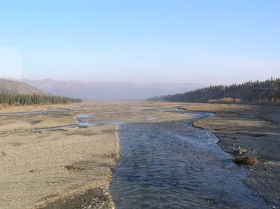
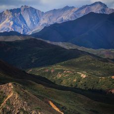
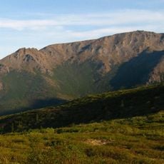
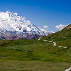
Stampede Trail is a wilderness route in the Denali Borough of Alaska passing through remote backcountry terrain. The first 8 miles consist of maintained gravel surface before the path transitions into a primitive track crossing tundra and multiple waterways.

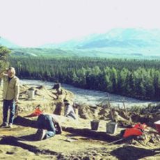
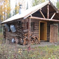
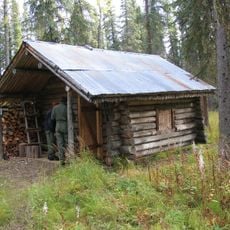
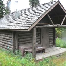
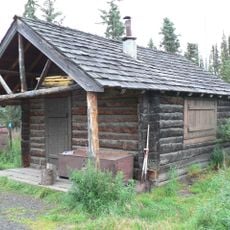
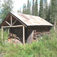
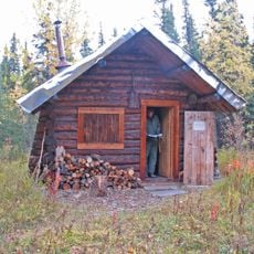
Gold prospectors established this path in 1903 as a connection between Lignite and the Kantishna mining district. Earl Pilgrim used the route during the 1930s to haul antimony ore by dog sled to the railroad.

The route carries the name from the gold rush era when miners stampeded into Alaska seeking fortune in the Kantishna hills. Today hikers follow the same path that once saw pack animals and sleds hauling supplies through the wilderness.

The Teklanika River becomes a serious obstacle during summer months when snowmelt raises water levels requiring wading gear and caution. Late August through September offers lower water levels making the crossing somewhat safer for experienced hikers.

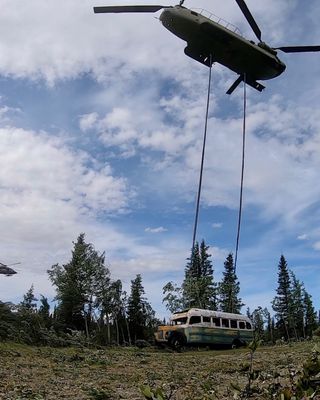
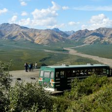
An abandoned Fairbanks City Transit bus from the 1940s sat beside the path for decades serving as shelter for trappers. The National Guard airlifted the vehicle out in 2020 after it prompted multiple rescue operations.

The community of curious travelers

AroundUs brings together thousands of curated places, local tips, and hidden gems, enriched daily by 60,000 contributors worldwide.

Start exploring
Location
Address
Stampede Trail, Alaska 99743, USA
GPS coordinates
63.86840,-149.76900
Latest update
December 17, 2025 16:16
Around this place
Magic Bus
United States of America

Magic Bus

36.9 km
Pearson Cabin
United States of America

Pearson Cabin

41.7 km
Dry Creek Archeological Site
United States of America

Dry Creek Archeological Site

37.1 km
Lower East Fork Ranger Cabin No. 9
United States of America

Lower East Fork Ranger Cabin No. 9

13 km
Sushana River Ranger Cabin No. 17
United States of America

Sushana River Ranger Cabin No. 17

7.8 km
Mount Sheldon
United States of America

Mount Sheldon

35.3 km
Igloo Creek Cabin No. 25
United States of America

Igloo Creek Cabin No. 25

30.2 km
Mount Margaret
United States of America

Mount Margaret

23.8 km
Sanctuary River Cabin No. 31
United States of America

Sanctuary River Cabin No. 31

21.8 km
Lower Toklat River Ranger Cabin No. 18
United States of America

Lower Toklat River Ranger Cabin No. 18

24.8 km
United States of America

Polychrome Glaciers

46.1 km
Ewe Creek Ranger Cabin No. 8
United States of America

Ewe Creek Ranger Cabin No. 8

22.1 km
Upper East Fork Cabin No. 29
United States of America

Upper East Fork Cabin No. 29

34.6 km
Upper Toklat River Cabin No. 24
United States of America

Upper Toklat River Cabin No. 24

41.2 km
Mount McKinley National Park Road Historic District
United States of America

Mount McKinley National Park Road Historic District

42.6 km
Polychrome Overlook
United States of America

Polychrome Overlook

37.2 km
United States of America

Polychrome Pass

36.4 km
United States of America

Ancien emplacement du Bus magique

15 m
United States of America

49th State Brewing

36.9 km
United States of America

Magic Bus Replica

36.9 km
United States of America

Black Diamond Golf Course

35.8 km
United States of America

Polychrome Overlook

37.2 km
United States of America

Scenic viewpoint

31.8 km
United States of America

Teklanika River Viewpoint

25.8 km
United States of America

Denali Viewpoint

24.2 km
United States of America

Scenic viewpoint

34.8 km
United States of America

Scenic viewpoint

29.2 km
United States of America

Scenic viewpoint

25.6 km
Show the full map
Reviews
Share your experience

No review yet

Discussions
Start a discussion...

No discussion yet

« Stampede Trail - Wilderness trail in Denali Borough, Alaska, US » is provided by Around Us (aroundus.com). Images and texts are derived from Wikimedia project under a Creative Commons license. You are allowed to copy, distribute, and modify copies of this page, under the conditions set by the license, as long as this note is clearly visible.

Discover hidden gems everywhere you go!

From secret cafés to breathtaking viewpoints, skip the crowded tourist spots and find places that match your style. Our app makes it easy with voice search, smart filtering, route optimization, and insider tips from travelers worldwide. Download now for the complete mobile experience.

Around Us App Screenshot

A unique approach to discovering new places

Le Figaro

All the places worth exploring

France Info

A tailor-made excursion in just a few clicks

20 Minutes

Around Us
Travel Guide & Maps
Download

Send to your phone

QR Code
1

Open the camera app on your mobile.

2

Point at the QR code with your camera. A notification will appear.

3

Tap the notification to open the link.