Enable Location

We need your location to show you interesting places around you

Discover nearby places

Find interesting locations and hidden gems around you

Precise directions

Get accurate directions and distances to places

Your location is never shared with other users. It's only used when you tap the location button.

Mount Orizaba

Log in to your account

Start exploring — it's free

Trusted by 66,060 travelers worldwide

Continue with Google
Continue with Apple
or

We will send you a code to connect

By continuing, you accept our Terms and Conditions and our Privacy Policy

Check your inbox

We've sent a pincode in your inbox. Please enter the code below.

Mount Orizaba
Discussion Reviews 1 Photos
6.2k Popularity

Mount Orizaba, Mountain summit on Santa Catalina Island, United States

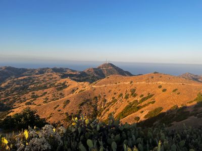
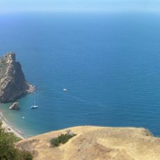
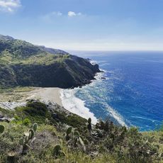
Mount Orizaba is the highest point on Santa Catalina Island at about 2,097 feet, offering views across to San Clemente Island and toward the San Gabriel Mountains. The summit is reached by established hiking trails that wind through the island's terrain.

The summit gained historical note from an exceptional weather event in January 1949, when unusual snowfall deposited snow at its peak, a rare occurrence for the island climate. This event remains memorable as an unusual departure from the region's typical conditions.

The mountain takes its name from Pico de Orizaba in Mexico, reflecting geographical ties between California and Mexican naming traditions. This connection shows how regional identity spans across borders through shared language and history.

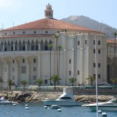
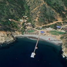
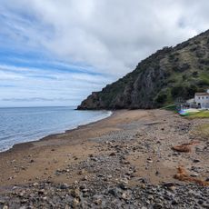
Reaching the mountain requires a ferry from ports such as San Pedro, Dana Point, or Long Beach, followed by hiking on established trails. Visitors should bring plenty of water and sturdy footwear, and check weather conditions before setting out.

The summit hosts a VORTAC navigation system maintained by the Federal Aviation Administration, providing guidance to aircraft over Southern California. This technical facility demonstrates how even remote peaks serve essential roles in modern aviation operations.

The community of curious travelers

AroundUs brings together thousands of curated places, local tips, and hidden gems, enriched daily by 60,000 contributors worldwide.

Start exploring
Location
Address
Mt Orizaba, California 90704, USA
GPS coordinates
33.37697,-118.41813
Latest update
March 4, 2026 19:16
Reviews
Share your experience

No review yet

Discussions
Start a discussion...

No discussion yet

« Mount Orizaba - Mountain summit on Santa Catalina Island, United States » is provided by Around Us (aroundus.com). Images and texts are derived from Wikimedia project under a Creative Commons license. You are allowed to copy, distribute, and modify copies of this page, under the conditions set by the license, as long as this note is clearly visible.

Discover hidden gems everywhere you go!

From secret cafés to breathtaking viewpoints, skip the crowded tourist spots and find places that match your style. Our app makes it easy with voice search, smart filtering, route optimization, and insider tips from travelers worldwide. Download now for the complete mobile experience.

Around Us App Screenshot

A unique approach to discovering new places

Le Figaro

All the places worth exploring

France Info

A tailor-made excursion in just a few clicks

20 Minutes

Around Us
Travel Guide & Maps
Download

Send to your phone

QR Code
1

Open the camera app on your mobile.

2

Point at the QR code with your camera. A notification will appear.

3

Tap the notification to open the link.