Chest opened
+${chestReward.xp} XP
Explorer
NOUVEAU ×${chestReward.collectible.quantity}
tapez pour fermer
Chest locked

Open chests in the app

Around Us is built for your phone — chests unlock when you walk, explore and capture nearby places.

Enable Location

We need your location to show you interesting places around you

Discover nearby places

Find interesting locations and hidden gems around you

Precise directions

Get accurate directions and distances to places

Your location is never shared with other users. It's only used when you tap the location button.

Rancho Santa Fe

Log in to your account

Start exploring — it's free

Trusted by 72,986 travelers worldwide

Continue with Google
Continue with Apple
or

We will send you a code to connect

By continuing, you accept our Terms and Conditions and our Privacy Policy

Check your inbox

We've sent a pincode in your inbox. Please enter the code below.

Discussion Reviews 2 Photos
97.4k Popularity

Rancho Santa Fe, Census-designated residential district in San Diego County, California

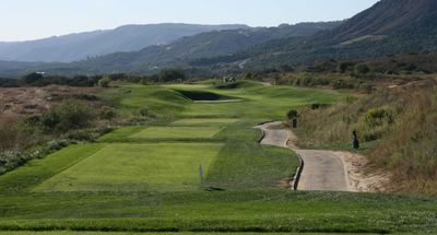
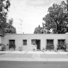
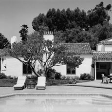
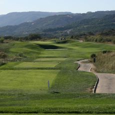
Rancho Santa Fe is a residential district in San Diego County, California, that spreads across rolling terrain with numerous large estates. The settlement lies several miles from the Pacific and consists of sprawling properties between eucalyptus groves and private golf courses.

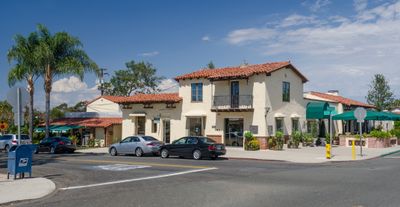
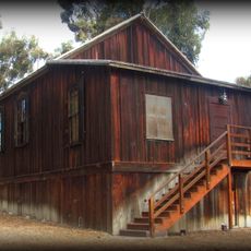
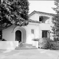
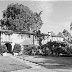
The Santa Fe Railway purchased the land in 1906 to establish a eucalyptus plantation for producing railroad ties. Architect Lilian Rice designed the development plan starting in 1921 for today's residential settlement in the Spanish Colonial Revival style.

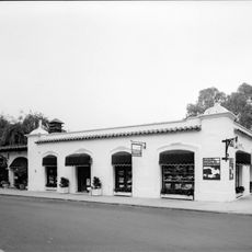
The Spanish place names and the white stucco buildings with tile roofs shape how the settlement appears, planned from the start as an exclusive residential development. Residents use post office boxes instead of home delivery, which reflects the loose layout of the development.

Several shopping centers and restaurants lie scattered throughout the area and can be easily reached by car. Visitors should note that most areas are private property and public facilities are limited.

The eucalyptus trees proved unsuitable for railroad construction and now form extensive groves along the roads and estates. Some of these trees reach heights exceeding 100 feet (30 meters) and shape how the entire area looks.

The community of curious travelers

AroundUs brings together thousands of curated places, local tips, and hidden gems, enriched daily by 60,000 contributors worldwide.

Start exploring
Location
Architects
Lilian Jeannette Rice
GPS coordinates
33.02389,-117.20000
Latest update
December 12, 2025 23:35
Around this place
San Elijo Lagoon
United States of America

San Elijo Lagoon

6 km
Annie's Canyon Trail
United States of America

Annie's Canyon Trail

6.3 km
United States of America

San Dieguito County Park

4.3 km
Olivenhain Town Meeting Hall
United States of America

Olivenhain Town Meeting Hall

3.9 km
Rancho Santa Fe Land and Improvement Company Office
United States of America

Rancho Santa Fe Land and Improvement Company Office

571 m
Casa Pearl Baker Row
United States of America

Casa Pearl Baker Row

374 m
Casa Charles A. Shaffer
United States of America

Casa Charles A. Shaffer

2.4 km
Casa Norman and Florence B. Carmichael
United States of America

Casa Norman and Florence B. Carmichael

1.4 km
Casa Reginald M. and Constance Clotfelter Row
United States of America

Casa Reginald M. and Constance Clotfelter Row

425 m
United States of America

Lilian Jenette Rice House

823 m
Casa Samuel Bingham
United States of America

Casa Samuel Bingham

1.1 km
Rancho Santa Fe Golf Club
United States of America

Rancho Santa Fe Golf Club

1.9 km
United States of America

Cosmos Research Center

5.5 km
United States of America

San Dieguito Reservoir

1.8 km
United States of America

The Farms Golf Club at Rancho Santa Fe

4.5 km
United States of America

High Country Villas

4.9 km
United States of America

The Crosby Club

3.9 km
United States of America

The Bridges at Rancho Santa Fe

3.8 km
United States of America

The Bridges at Rancho Santa Fe

3.7 km
United States of America

Lomas Santa Fe Country Club

5.6 km
United States of America

Beltaire Park

5.4 km
United States of America

Lomas Sante Fe

4.7 km
United States of America

Statue, Work of art

4.6 km
United States of America

Scenic viewpoint

6.3 km
United States of America

Tern Point

5.3 km
United States of America

Scenic viewpoint

5.2 km
United States of America

Scenic viewpoint

6.3 km
United States of America

Scenic viewpoint

6.3 km
Show the full map
Reviews
Share your experience

No review yet

Discussions
Start a discussion...

No discussion yet

« Rancho Santa Fe - Census-designated residential district in San Diego County, California » is provided by Around Us (aroundus.com). Images and texts are derived from Wikimedia project under a Creative Commons license. You are allowed to copy, distribute, and modify copies of this page, under the conditions set by the license, as long as this note is clearly visible.

Discover hidden gems everywhere you go!

From secret cafés to breathtaking viewpoints, skip the crowded tourist spots and find places that match your style. Our app makes it easy with voice search, smart filtering, route optimization, and insider tips from travelers worldwide. Download now for the complete mobile experience.

Around Us App Screenshot

A unique approach to discovering new places

Le Figaro

All the places worth exploring

France Info

A tailor-made excursion in just a few clicks

20 Minutes

Around Us
Travel Guide & Maps
Download

Send to your phone

QR Code
1

Open the camera app on your mobile.

2

Point at the QR code with your camera. A notification will appear.

3

Tap the notification to open the link.