Chest opened
+${chestReward.xp} XP
Explorer
NOUVEAU ×${chestReward.collectible.quantity}
tapez pour fermer
Chest locked

Open chests in the app

Around Us is built for your phone — chests unlock when you walk, explore and capture nearby places.

Enable Location

We need your location to show you interesting places around you

Discover nearby places

Find interesting locations and hidden gems around you

Precise directions

Get accurate directions and distances to places

Your location is never shared with other users. It's only used when you tap the location button.

Hacienda Heights

Log in to your account

Start exploring — it's free

Trusted by 72,973 travelers worldwide

Continue with Google
Continue with Apple
or

We will send you a code to connect

By continuing, you accept our Terms and Conditions and our Privacy Policy

Check your inbox

We've sent a pincode in your inbox. Please enter the code below.

Discussion Reviews 2 Photos
54.8k Popularity

Hacienda Heights, Administrative division in Los Angeles County, California, United States.

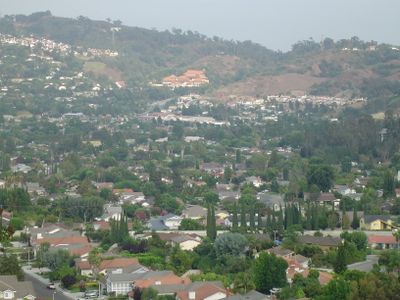
Hacienda Heights is a residential community in the eastern San Gabriel Valley of California, spreading between several neighboring towns along the Pomona Freeway. The area consists mainly of single-family homes, elementary schools, parks, and shopping centers along the main roads.

The area originally belonged to Rancho La Puente, which was operated by Mission San Gabriel during Spanish rule. After Mexican independence, John Rowland and William Workman acquired the land in 1845 and turned it into a cattle ranch.

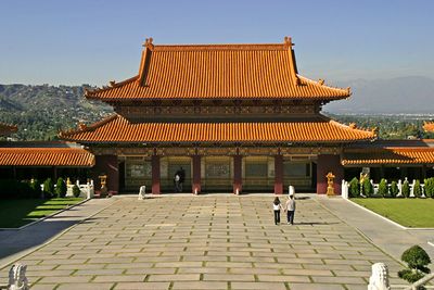
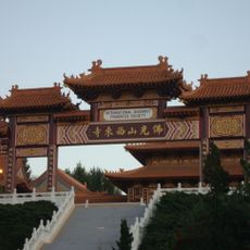
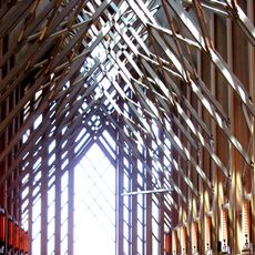
The Hsi Lai Temple attracts visitors with its curved roofs and red columns that show traditional Chinese construction. Inside the courtyard, guests can explore prayer halls, a garden, and a Buddhist library while monks carry out their daily rituals.

The area sits between several highways, so visitors driving can reach most destinations easily. Police and fire services operate from multiple stations throughout the area and provide quick help in emergencies.

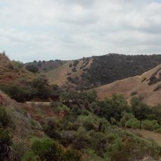
Fruit trees and walnut groves once covered much of the landscape until plant diseases in the 1940s destroyed the crops. After that, construction companies bought the land and began building homes in the 1950s that now dominate the scenery.

The community of curious travelers

AroundUs brings together thousands of curated places, local tips, and hidden gems, enriched daily by 60,000 contributors worldwide.

Start exploring
Elevation above the sea
138 m
Shares border with
La Habra Heights, City of Industry
GPS coordinates
34.00056,-117.96944
Latest update
December 20, 2025 11:17
Around this place
Hsi Lai Temple
United States of America

Hsi Lai Temple

2.8 km
Turnbull Canyon
United States of America

Turnbull Canyon

4.2 km
Workman and Temple Family Homestead Museum
United States of America

Workman and Temple Family Homestead Museum

2.2 km
Jonathan Bailey House
United States of America

Jonathan Bailey House

6 km
Hoover Hotel
United States of America

Hoover Hotel

6.6 km
John A. Rowland House
United States of America

John A. Rowland House

1.6 km
El Campo Santo Cemetery
United States of America

El Campo Santo Cemetery

2.1 km
National Bank of Whittier Building
United States of America

National Bank of Whittier Building

6.6 km
Standard Oil Building
United States of America

Standard Oil Building

6.8 km
Skyrose Chapel
United States of America

Skyrose Chapel

5 km
United States of America

California Country Club

6.2 km
United States of America

Flukes

6.3 km
United States of America

Friendly Hills Country Club

4.8 km
United States of America

The Industry Hills Golf Club - Babe Zaharias Course

4.6 km
United States of America

The Industry Hills Golf Club - Ike (Dwight D Eisenhower) Course

4.4 km
United States of America

The Industry Hills Golf Club (Dwight D Eisenhower & Babe Zaharias)

4.5 km
United States of America

Boy Scout Amphitheater

4.1 km
United States of America

The Dress

6.7 km
United States of America

Crab Louis

6.7 km
United States of America

Hacienda Golf Club

4.8 km
United States of America

From the Tree

6.7 km
United States of America

Red Rascal

6.6 km
United States of America

San Angelo Landscape

6.3 km
United States of America

Figure

6.2 km
United States of America

Circles of a Ripple

1.7 km
United States of America

Bridge Railing

4.5 km
United States of America

Mural, Work of art

5.9 km
United States of America

Scenic viewpoint

4 km
Show the full map
Reviews
Share your experience

No review yet

Discussions
Start a discussion...

No discussion yet

« Hacienda Heights - Administrative division in Los Angeles County, California, United States » is provided by Around Us (aroundus.com). Images and texts are derived from Wikimedia project under a Creative Commons license. You are allowed to copy, distribute, and modify copies of this page, under the conditions set by the license, as long as this note is clearly visible.

Discover hidden gems everywhere you go!

From secret cafés to breathtaking viewpoints, skip the crowded tourist spots and find places that match your style. Our app makes it easy with voice search, smart filtering, route optimization, and insider tips from travelers worldwide. Download now for the complete mobile experience.

Around Us App Screenshot

A unique approach to discovering new places

Le Figaro

All the places worth exploring

France Info

A tailor-made excursion in just a few clicks

20 Minutes

Around Us
Travel Guide & Maps
Download

Send to your phone

QR Code
1

Open the camera app on your mobile.

2

Point at the QR code with your camera. A notification will appear.

3

Tap the notification to open the link.