Enable Location

We need your location to show you interesting places around you

Discover nearby places

Find interesting locations and hidden gems around you

Precise directions

Get accurate directions and distances to places

Your location is never shared with other users. It's only used when you tap the location button.

Casa Grande Ruins National Monument

Log in to your account

Start exploring — it's free

Trusted by 62,926 travelers worldwide

Continue with Google
Continue with Apple
or

We will send you a code to connect

By continuing, you accept our Terms and Conditions and our Privacy Policy

Check your inbox

We've sent a pincode in your inbox. Please enter the code below.

Discussion Reviews 5 Photos
38.5k Popularity

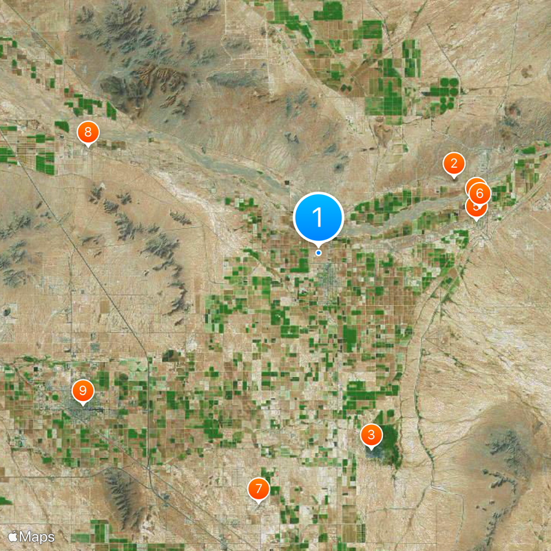
Casa Grande Ruins National Monument, Archaeological site in Coolidge, Arizona.

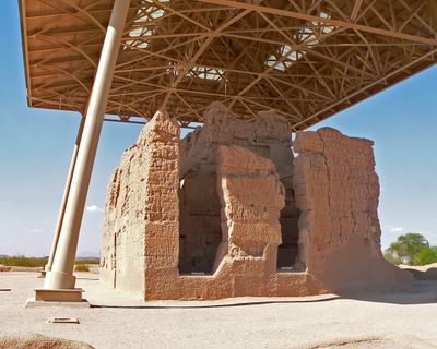
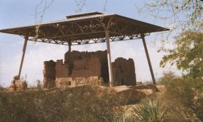
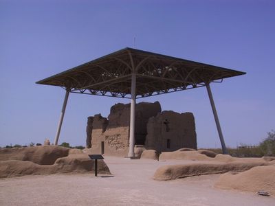
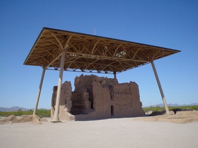
Casa Grande is an archaeological site in the Gila Valley containing the remains of buildings constructed by Hohokam farmers and enclosed by a compound wall. The central four-story structure was built from caliche, a sun-hardened soil and limestone mixture found locally.

The Hohokam built this settlement between 1300 and 1450 as part of a larger network of farms that eventually abandoned the area. The site became a protected monument in 1892, marking one of the first times the nation preserved a prehistoric location.

The Hohokam farming communities created sophisticated irrigation systems that linked settlements across the valley, demonstrating how people worked together to survive in the desert. The way these canals are still visible across the landscape tells us how important shared resources were to their way of life.

The site sits in the Sonora Desert and is open year-round, with a covered steel shelter protecting the main structure. The ground is flat and easy to walk on, but bring water and sun protection as shade is limited throughout the grounds.

The four-story main structure was built from caliche and has survived over 700 years under a modern steel protective canopy added in the 1930s. This metal shelter was a pioneering conservation solution to protect fragile adobe-like structures from harsh desert heat and weather.

The community of curious travelers

AroundUs brings together thousands of curated places, local tips, and hidden gems, enriched daily by 60,000 contributors worldwide.

Start exploring
Location
Inception
June 22, 1892
Operator
National Park Service
GPS coordinates
32.99700,-111.53200
Latest update
February 8, 2026 09:32
Around this place
Poston Butte
United States of America

Poston Butte

13.2 km
United States of America

Picacho Reservoir

17.2 km
McFarland State Historic Park
United States of America

McFarland State Historic Park

14.1 km
Florence High School
United States of America

Florence High School

13.8 km
Second Pinal County Courthouse
United States of America

Second Pinal County Courthouse

14.3 km
Eloy Municipal Airport
United States of America

Eloy Municipal Airport

21.8 km
C.H. Cook Memorial Church
United States of America

C.H. Cook Memorial Church

21.5 km
White House
United States of America

White House

23.8 km
First Presbyterian Church of Florence
United States of America

First Presbyterian Church of Florence

14.3 km
Harvey-Niemeyer House
United States of America

Harvey-Niemeyer House

14 km
Walter Wilbur House
United States of America

Walter Wilbur House

23.6 km
Casa Grande Hospital
United States of America

Casa Grande Hospital

24.1 km
McFarland State Historic Park
United States of America

McFarland State Historic Park

14.1 km
The Golf Club at Johnson Ranch
United States of America

The Golf Club at Johnson Ranch

18.1 km
Casa Grande City Hall
United States of America

Casa Grande City Hall

24 km
United States of America

Lenomiya observatory

22.8 km
Casa Grande Ruins National Monument Visitor Center
United States of America

Casa Grande Ruins National Monument Visitor Center

503 m
Sacaton Dam Bridge
United States of America

Sacaton Dam Bridge

17.7 km
United States of America

Mormon Battalion Historical Monument

22.8 km
United States of America

Palm Creek Resort & Residences

20 km
United States of America

Golf Club at Oasis

11.3 km
United States of America

Poston Butte Golf Club

10.3 km
United States of America

Robson Ranch Arizona Golf Club

22.5 km
United States of America

Mission Royale Golf Club

19.5 km
United States of America

Casa Grande Auditorium

519 m
United States of America

Coolidge Performing Arts Center

1.8 km
United States of America

Casa Grande Capsule

17.2 km
United States of America

Work of art, sculpture

23.5 km
Show the full map
Reviews
Share your experience

No review yet

Discussions
Start a discussion...

No discussion yet

« Casa Grande Ruins National Monument - Archaeological site in Coolidge, Arizona » is provided by Around Us (aroundus.com). Images and texts are derived from Wikimedia project under a Creative Commons license. You are allowed to copy, distribute, and modify copies of this page, under the conditions set by the license, as long as this note is clearly visible.

Discover hidden gems everywhere you go!

From secret cafés to breathtaking viewpoints, skip the crowded tourist spots and find places that match your style. Our app makes it easy with voice search, smart filtering, route optimization, and insider tips from travelers worldwide. Download now for the complete mobile experience.

Around Us App Screenshot

A unique approach to discovering new places

Le Figaro

All the places worth exploring

France Info

A tailor-made excursion in just a few clicks

20 Minutes

Around Us
Travel Guide & Maps
Download

Send to your phone

QR Code
1

Open the camera app on your mobile.

2

Point at the QR code with your camera. A notification will appear.

3

Tap the notification to open the link.