Enable Location

We need your location to show you interesting places around you

Discover nearby places

Find interesting locations and hidden gems around you

Precise directions

Get accurate directions and distances to places

Your location is never shared with other users. It's only used when you tap the location button.

Theodore Roosevelt Lake

Log in to your account

Start exploring — it's free

Trusted by 61,550 travelers worldwide

Continue with Google
Continue with Apple
or

We will send you a code to connect

By continuing, you accept our Terms and Conditions and our Privacy Policy

Check your inbox

We've sent a pincode in your inbox. Please enter the code below.

Theodore Roosevelt Lake

Theodore Roosevelt Lake, Recreational reservoir in Maricopa County, Arizona, US

Description

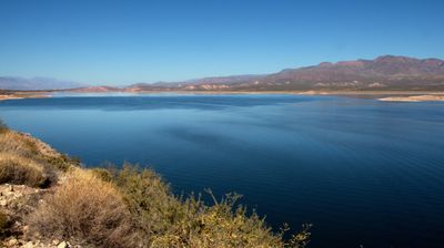
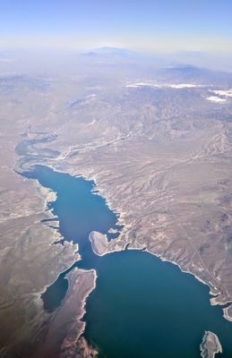
Theodore Roosevelt Lake sits about 80 miles (130 kilometers) northeast of Phoenix in the Sonoran Desert, stretching 22 miles (36 kilometers) between steep rock walls. The water fills a narrow valley framed by reddish cliffs and slopes dotted with cactus, while the horizon is bounded by the Mazatzal Mountains to the north.

History

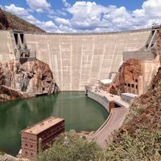
The dam was built between 1905 and 1911 as the first major federal irrigation project in the American West. President Theodore Roosevelt dedicated the structure in 1911, after which the reservoir was named in his honor.

Culture

The surrounding Tonto National Forest provides recreational opportunities through designated hiking trails, camping areas, and fishing locations for outdoor enthusiasts.

Practical

Several ramps and marinas provide access for boats, while rental shops offer equipment for water sports and fishing. Summer temperatures often reach 100 degrees Fahrenheit (38 degrees Celsius), so spring or fall visits offer more comfortable conditions.

Did you know?

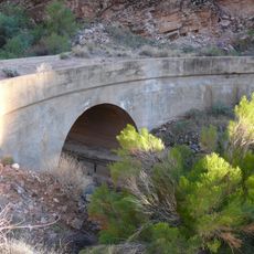
The water level fluctuates widely depending on season and irrigation demand, revealing broad shoreline zones of pale sediment that form rings around the water. When the level drops, old structures and bridge remnants from before the dam appear above the surface.

Location
GPS coordinates
33.67167,-111.15000
Latest update
December 20, 2025 13:16

AroundUs brings together thousands of curated places, local tips, and hidden gems, enriched daily by 60,000 contributors worldwide. Discover all places nearby (Gila County).

« Theodore Roosevelt Lake - Recreational reservoir in Maricopa County, Arizona, US » is provided by Around Us (aroundus.com). Images and texts are derived from Wikimedia project under a Creative Commons license. You are allowed to copy, distribute, and modify copies of this page, under the conditions set by the license, as long as this note is clearly visible.

Discover hidden gems everywhere you go!

From secret cafés to breathtaking viewpoints, skip the crowded tourist spots and find places that match your style. Our app makes it easy with voice search, smart filtering, route optimization, and insider tips from travelers worldwide. Download now for the complete mobile experience.

Around Us App Screenshot

A unique approach to discovering new places

Le Figaro

All the places worth exploring

France Info

A tailor-made excursion in just a few clicks

20 Minutes

Around Us
Travel Guide & Maps
Download

Send to your phone

QR Code
1

Open the camera app on your mobile.

2

Point at the QR code with your camera. A notification will appear.

3

Tap the notification to open the link.