Chest opened
+${chestReward.xp} XP
Explorer
NOUVEAU ×${chestReward.collectible.quantity}
tapez pour fermer
Chest locked

Open chests in the app

Around Us is built for your phone — chests unlock when you walk, explore and capture nearby places.

Enable Location

We need your location to show you interesting places around you

Discover nearby places

Find interesting locations and hidden gems around you

Precise directions

Get accurate directions and distances to places

Your location is never shared with other users. It's only used when you tap the location button.

Log in to your account

Start exploring — it's free

Trusted by 72,886 travelers worldwide

Continue with Google
Continue with Apple
or

We will send you a code to connect

By continuing, you accept our Terms and Conditions and our Privacy Policy

Check your inbox

We've sent a pincode in your inbox. Please enter the code below.

Tucson Cutoff
Discussion Reviews Photo
1.2k Popularity

Tucson Cutoff, Historical transport route in southwestern Arizona, US

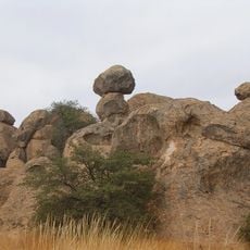
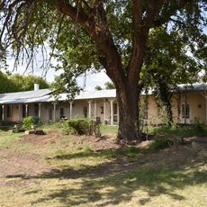
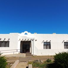
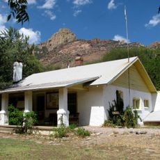
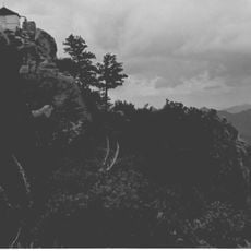
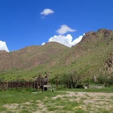
The Tucson Cutoff is a historical transport route running through southwestern Arizona that passes through mountain ranges and desert valleys. The path connects several natural water sources while crossing areas like the Sulphur Springs Valley and passing through named passes and springs.

The route was established in 1849 as a shortcut by early travelers seeking a faster path than existing alternatives. It developed from the practical need to reduce travel time and effort for those moving westward.

The route carries names reflecting early travelers who crossed this terrain, with locations named after those who pioneered paths through the region. These place names remain as reminders of how travelers shaped the landscape they moved through.

Visitors should bring detailed maps and navigation tools since the route passes through remote mountain areas and desert valleys. Conditions and accessibility can vary across different sections, so it helps to check conditions before traveling.

The route relied on multiple natural springs like those named after early travelers, which were vital for crossing the desert landscape. These water sources made the difficult journey through remote terrain actually feasible.

The community of curious travelers

AroundUs brings together thousands of curated places, local tips, and hidden gems, enriched daily by 60,000 contributors worldwide.

Start exploring
GPS coordinates
32.31030,-108.61100
Latest update
December 14, 2025 18:20
Around this place
City of Rocks State Park
United States of America

City of Rocks State Park

67.3 km
Fort Bayard
United States of America

Fort Bayard

69.3 km
Shakespeare
United States of America

Shakespeare

12.1 km
Fort Bayard National Cemetery
United States of America

Fort Bayard National Cemetery

69.2 km
L.C. Ranch Headquarters
United States of America

L.C. Ranch Headquarters

72.9 km
Silver City Woman's Club
United States of America

Silver City Woman's Club

61.5 km
Chiricahua National Monument Historic Designed Landscape
United States of America

Chiricahua National Monument Historic Designed Landscape

74.9 km
Portal Ranger Station
United States of America

Portal Ranger Station

69.2 km
Fleming Hall
United States of America

Fleming Hall

60.4 km
Silver City Historic District
United States of America

Silver City Historic District

60.2 km
Bullard Hotel
United States of America

Bullard Hotel

60.1 km
Benjamin F. Billingsley House
United States of America

Benjamin F. Billingsley House

65.2 km
Silver City Water Works Building
United States of America

Silver City Water Works Building

61.2 km
Hidalgo County Courthouse
United States of America

Hidalgo County Courthouse

9.9 km
Bowden Hall
United States of America

Bowden Hall

60.3 km
H. B. Ailman House
United States of America

H. B. Ailman House

60 km
Light Hall
United States of America

Light Hall

60.4 km
Lordsburg-Hidalgo County Library
United States of America

Lordsburg-Hidalgo County Library

10 km
Old Lordsburg High School
United States of America

Old Lordsburg High School

10.4 km
Chihuahua Hill Historic District
United States of America

Chihuahua Hill Historic District

59.6 km
Ritch Hall
United States of America

Ritch Hall

60.4 km
Graham Gymnasium
United States of America

Graham Gymnasium

60.3 km
Silver CIty Museum
United States of America

Silver CIty Museum

60 km
Chiricahua Desert Museum
United States of America

Chiricahua Desert Museum

63.2 km
Silver Peak Lookout Complex
United States of America

Silver Peak Lookout Complex

71.4 km
Western New Mexico University Museum
United States of America

Western New Mexico University Museum

60.4 km
Sugarloaf Mountain Lookout
United States of America

Sugarloaf Mountain Lookout

74.9 km
Horseshoe Canyon
United States of America

Horseshoe Canyon

76.6 km
Show the full map
Reviews
Share your experience

No review yet

Discussions
Start a discussion...

No discussion yet

« Tucson Cutoff - Historical transport route in southwestern Arizona, US » is provided by Around Us (aroundus.com). Images and texts are derived from Wikimedia project under a Creative Commons license. You are allowed to copy, distribute, and modify copies of this page, under the conditions set by the license, as long as this note is clearly visible.

Discover hidden gems everywhere you go!

From secret cafés to breathtaking viewpoints, skip the crowded tourist spots and find places that match your style. Our app makes it easy with voice search, smart filtering, route optimization, and insider tips from travelers worldwide. Download now for the complete mobile experience.

Around Us App Screenshot

A unique approach to discovering new places

Le Figaro

All the places worth exploring

France Info

A tailor-made excursion in just a few clicks

20 Minutes

Around Us
Travel Guide & Maps
Download

Send to your phone

QR Code
1

Open the camera app on your mobile.

2

Point at the QR code with your camera. A notification will appear.

3

Tap the notification to open the link.